
Canton Grimaud INSEE/Postal code 83063 / 83680 Population 1,619 (1999) | Department Var Time zone CET (UTC+1) Area 76.64 km² Local time Friday 4:59 AM | |
 | ||
Weather 7°C, Wind NW at 14 km/h, 82% Humidity Points of interest Conservatoire du Patrimoin, Fort Freinet, La Fontaine Vieille, Le Clocher Tour, La Croix Des Maures | ||
Asphalt moments french countryside vidi la garde freinet to la haute court 14 10 08
La Garde-Freinet is a commune in the Var department in the Côte d'Azur area in southeastern France.
Contents
- Asphalt moments french countryside vidi la garde freinet to la haute court 14 10 08
- Map of La Garde Freinet France
- Location
- History
- Sights
- People
- References
Map of La Garde-Freinet, France
Location
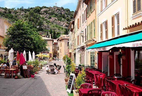
La Garde-Freinet is a medieval French mountain village, located in the Massif des Maures, 15 km northwest of Saint-Tropez. Accessible by picturesque winding roads, through forests of cork, oaks, and chestnuts.
History
The village was the site of Fraxinet, a Moorish settlement of the ninth to tenth centuries.
Sights
Established in the 11th century, the village has preserved its character with its field stone houses, old fashioned street names, and a village square framed with restaurants and local art galleries. From atop old Fort Freinet one can see the plains of Saint-Clément and the Argens valley, all the way to the Alps.
People
References
La Garde-Freinet Wikipedia(Text) CC BY-SA