Department Ain Canton Villars-les-Dombes Area 13.37 km² | Intercommunality Centre Dombes Local time Friday 2:20 AM | |
 | ||
Weather 11°C, Wind NW at 8 km/h, 77% Humidity | ||
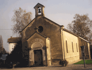
La Chapelle-du-Châtelard is a commune in the Ain department in eastern France.
Contents
Map of La Chapelle-du-Ch%C3%A2telard, France
Geography
The Chalaronne forms the commune's southeastern border, flows northwest through the northern part of the commune, then forms part of its northwestern border.
References
La Chapelle-du-Châtelard Wikipedia(Text) CC BY-SA
