
Country France Local time Friday 12:38 AM | Region Occitanie Area 20.56 km² | |
 | ||
Intercommunality Larzac-Templier Causses et Vallées Weather 8°C, Wind N at 19 km/h, 81% Humidity | ||
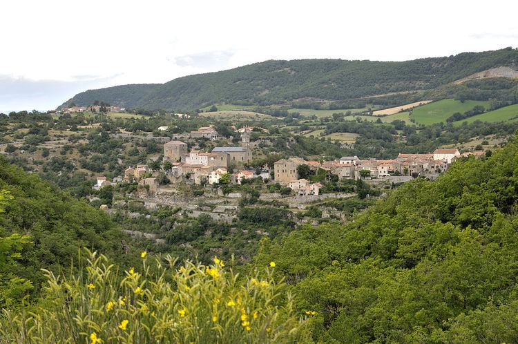
La Bastide-Pradines is a French commune in the Aveyron department in the Occitanie region of southern France.
Contents
- Map of 12490 La Bastide Pradines France
- Geography
- Mapping
- Toponymy
- History
- Administration
- Demography
- Sites and Monuments
- Notable people linked to the commune
- References
Map of 12490 La Bastide-Pradines, France
The inhabitants of the commune are known as Bastidois or Bastidoises.
Geography
La Bastide-Pradines is located some 50 km south-east of Rodez and 10 km north-east of Saint-Affrique in the heart of the Parc naturel régional des Grands Causses. Access to the commune is by the A75 autoroute which passes through the north of the commune from north-west to east with Exit 46 in the commune and connecting to the D999. The D999 comes from Saint-Rome-de-Cernon in the west and passes through the centre of the commune north of the village and continues east to Exit 47 on the autoroute and to La Cavalerie. The D77 branches from Saint-Rome-de-Cernon by a southern route through the commune and the village and continues east to Lapanouse-de-Cernon. The D560 connects the village to the D999 to the north in the commune. A disused railway line passes through the commune from west to east south of the village. The commune is heavily forested in the south with the rest mainly farmland.
The Cernon river flows through the commune and the village from east to west and continues west then north joining the Tarn east of Comprégnac. The Ruisseau de Coufours rises in the north of the commune and flows south to join the Cernon near the village. The Ruisseau de Saute-Bouc rises in the north-east of the commune and flows south-west to join the Ruisseau de Coufours just north of the village. The Ruisseau des Clarous rises in the south of the commune and flows north to join the Cernon.
Mapping
A list of online mapping systems can be displayed by clicking on the coordinates (latitude and longitude) in the top right hand corner of this article.
Toponymy
La Bastide-Pradines appears as la Baftide de Pradines on the 1750 Cassini Map and as la Bastide de Pradines on the 1790 version.
History
Formerly called La Bastide de Sernonenque, La Bastide-Pradines was once a Commandry of the Knights Hospitaller.
Administration
List of Successive Mayors
(Not all data is known)
Demography
In 2010 the commune had 111 inhabitants. The evolution of the number of inhabitants is known from the population censuses conducted in the commune since 1793. From the 21st century, a census of communes with fewer than 10,000 inhabitants is held every five years, unlike larger communes that have a sample survey every year.
Sources : Ldh/EHESS/Cassini until 1962, INSEE database from 1968 (population without double counting and municipal population from 2006)