
Highest elevation 75 m (246 ft) Area 68,509 km² Local time Wednesday 3:19 PM | Founded March 7, 1881 Lowest elevation 61 m (200 ft) Population 38,451 (2008) Number of airports 1 | |
 | ||
Weather 32°C, Wind W at 8 km/h, 76% Humidity | ||
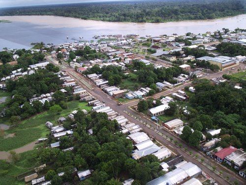
Lábrea ([ˈlabɾjɐ]) is the southernmost municipality in the Brazilian state of Amazonas.
Contents
Map of L%C3%A1brea - State of Amazonas, Brazil
Economy
The population of the Lábrea municipality was 38,451 as of 2008. Its area is 68,508.6 square kilometres (26,451.3 sq mi). This makes it the sixth largest municipality in Amazonas by area and the tenth largest in Brazil. The town is the seat of the Territorial Prelature of Lábrea. Lábrea Airport is served by scheduled regular air connections.
Conservation
The municipality contains the Iquiri National Forest, a 1,472,599 hectares (3,638,870 acres) sustainable use conservation unit created in 2008. The municipality also contains part of the Mapinguari National Park, a 1,776,914 hectares (4,390,850 acres) conservation unit created in 2008. It contains the 776,940 hectares (1,919,900 acres) Ituxi Extractive Reserve, created in 2008. It contains 91% of the 604,209 hectares (1,493,030 acres) Médio Purus Extractive Reserve, created in 2008.