
District Uzunköprü Time zone EET (UTC+2) Population 1,506 (2013) | Elevation 70 m (230 ft) Postal code 22360 Area code 0284 | |
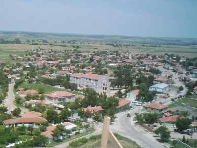 | ||
Kurtbey is a town in Uzunköprü district of Edirne Province, Turkey, situated in the eastern Trakya (Thrace) plains at 41°09′N 26°35′E. The distance to Uzunköprü is 25 kilometres (16 mi). The population of Kurtbey was 1506 as of 2013. The settlement was founded during the Rise of the Ottoman Empire (14th-15th centuries) by an akıncı ( Ottoman milita the 14th to 16th centuries) chief named Kurtbey. In the 19th century, especially following the Russo-Turkish War (1877-1878), Muslim refugees from Bulgaria (mostly Pomaks) and Romania were also settled in Kurtbey. In 1954, Kurtbey was declared a seat of township. The town economy depends on agriculture. The crops are wheat, rice, sunflower, sugarbeet and watermelon.
Map of Kurtbey, 22360 Kurtbey K%C3%B6y%C3%BC%2FUzunk%C3%B6pr%C3%BC%2FEdirne, Turkey
References
Kurtbey Wikipedia(Text) CC BY-SA