
Discharge 12.18 m³/s | Length 85 km Basin area 667 km² Mouth elevation 0 | |
 | ||
- average 12.18 m/s (430 cu ft/s) Mouth Sea of Japan (also known as East Sea) | ||
The Kurobe River (黒部川, Kurobe-gawa) is a river in Toyama Prefecture, Japan. 86 kilometres (53 mi) in length, it has a watershed of 689 km².
Map of Kurobe River, Toyama Prefecture, Japan
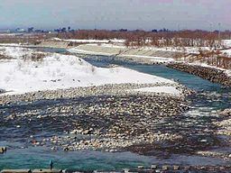
The river rises from Mount Washiba in the Hida Mountains and carves the deep valley known as the Kurobe gorge. It comes out of the mountains at Unazuki and forms an alluvial fan which directly sinks into the Sea of Japan.
The Kurobe River's rich flow and steep gradient offer good conditions for hydroelectricity. The Kurobe Dam is the tallest dam in Japan.
The name Kurobe is meaningless in Japanese. It appears to be an Ainu name, kur pet [kuɾᵘbet] 'shady river'.
References
Kurobe River Wikipedia(Text) CC BY-SA