
Prefecture-level divisions Aksu Elevation 1,072 m Prefecture-level division Aksu Prefecture | Time zone China Standard (UTC+8) Province Xinjiang | |
 | ||
Country People's Republic of China | ||
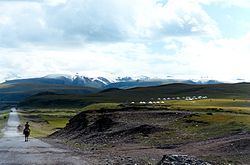
Kuqa County is a county in the Xinjiang Uyghur Autonomous Region under the administration of the Aksu Prefecture. It covers an area of 15,200 km2 (5,870 sq mi) and at the 2002 census had a population of 450,000. It was once the homeland of the ancient Buddhist Kingdom of Kucha.
Contents
Map of Kuqa, Aksu, Xinjiang, China
Geography
The county is located at the southern periphery of the Tian Shan range, the northern portion of the Tarim Basin, and the centre of the autonomous region. It occupies part of the northeastern portion of Aksu Prefecture, bordering Xinhe County, Xayar County, and Luntai County, Heiing County, and Lopnur County in Bayingolin Mongol Autonomous Region.
Kuqa County has nine towns and six townships under its administration, including Kuqa City, Wuqia Town, Alakaga Town, Yaha Town, Uzun Township, Bixibage Township, Agger Township. etc.
Kuqa has a continental desert climate (Köppen BWk), with an average annual precipitation of 74.6 millimetres (2.94 in), a majority of which occurs in summer. The monthly 24-hour average temperature ranges from −7.2 °C (19.0 °F) in January to 25.3 °C (77.5 °F) in July, and the annual mean is 11.29 °C (52.3 °F). The frost-free period lasts for 266 days on average. With monthly percent possible sunshine ranging from 54% in March to 69% in September and October, sunshine is abundant and the county receives 2,712 hours of bright sunshine annually.
Transport
Kuqa is served by China National Highway 217 and the Southern Xinjiang Railway.