
 | ||
Similar Lumangwe Falls, Chisimba Falls, Ntumbachushi Falls, Kabwelume Falls, Kalambo Falls | ||
Kundalila falls zambia
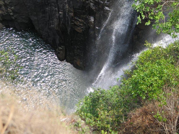
The Kaombe River in Zambia falls over the lip of the Muchinga escarpment and makes an exciting waterfall near the small town of Kanona in the Serenje District. The waterfall is called Kundalila Falls which means "crying dove" in the local Bemba language.
Contents
Map of Kundalila Falls, Zambia
GPS coordinates:
Location directions: Drive the T2 "Great North Road" up to Kanona where you see a junction signposted "Kundalila Falls 14km - National Monument" (GPS above). Follow the gravel road. After 500m you will cross the TAZARA railway tracks and at the end of the road you will reach the falls.
From top of the falls you have a spectacular view over the Luangwa Valley which is part of the Albertine Rift, the western branch of the East African Rift. In multiple stages the Kaombe River drops some 80m from the escarpment. At the foot of the fall is an area of great scenic beauty: a natural pool surrounded by famous wild flowers. Bathing is allowed and a camping site is open.
Kundalila Falls belongs to the list of official Zambian Natural Monuments, see Monuments and Historic Sites of Zambia.