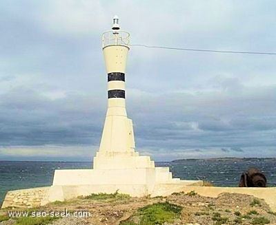
 | ||
Kumkale is a village in Çanakkale Province, Turkey.
Contents
- Map of Kumkale 17100 Kumkale KC3B6yC3BC2FC387anakkale Merkez2FC387anakkale Turkey
- Geography
- History
- Economy
- Trivia
- References
Map of Kumkale, 17100 Kumkale K%C3%B6y%C3%BC%2F%C3%87anakkale Merkez%2F%C3%87anakkale, Turkey
Geography
Kumkale at 39°59′N 26°14′E is in the central district of Çanakkale. It is within the National Park of Troy, (Troy is an ancient city included in the World heritage Sites in Turkey) . Its distance to Çanakkale is 27 kilometres (17 mi). Population of the village was 1200 as of 2014 .
History
Kumkale was a prosperous village before the First World War. But during the early phases of the Gallipoli Campaign, the village was evacuated because of French troop landing in the beach of the village. (see Battle of Kumkale) After the war the village was not repopulated. However in 1928 some people began to settle in a location slightly to the east of the former village. Former name of the new village was Mısırlık. But then the name Kumkale came into use. When Turkish minority in Bulgaria was expelled from Bulgaria a number of families were settled in Kumkale and Kumkale was declared a seat of township in 1992. However during the 2013 Turkish local government reorganisation its statue was changed to village.
Economy
Major economic activity is agriculture. Tomato is the most important product. Cotton and sun flower are also produced.
Trivia
According to some historians this village might be the starting place of Alexander the Great's campaign in Anatolia in the 4th century BC.
