Harman Patil (Editor)

Kumagaya, Saitama

Updated on
Edit
Like
Comment
Share on FacebookTweet on TwitterShare on LinkedInShare on Reddit
Country
  
Japan

Prefecture
  
Saitama Prefecture

- Flower
  
Sakura

Local time
  
Sunday 7:44 AM

Region
  
Kantō

- Tree
  
Zelkova serrata

Population
  
203,180 (2010)

Kumagaya, Saitama wwwjapantimescojpwpcontentuploads201408p1

Time zone
  
Japan Standard Time (UTC+9)

Weather
  
9°C, Wind W at 29 km/h, 60% Humidity

Points of interest
  
Beppunuma Park, Takashiro Shrine, Arakawaoaso Park, Manpei Park, Central Park

A walk through a japanese city kumagaya saitama
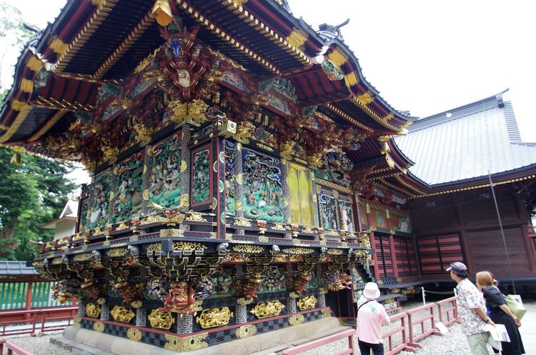

Kumagaya (熊谷市, Kumagaya-shi) is a city located in Saitama Prefecture, in the central Kantō region of Japan. As of 1 February 2016, the city had an estimated population of 198,440 and a population density of 1240 persons per km². Its total area was 159.82 square kilometres (61.71 sq mi).

Contents

Map of Kumagaya, Saitama Prefecture, Japan

Geography

Kumagaya is one of the largest cities in northern Saitama Prefecture. Eight national highways and three railway lines serve the city. While many people commute towards south Tokyo, its daytime population is larger than the night population thanks to commuters from surrounding towns. The city is located on the east edge of Arakawa River alluvial fan, approximately 60 km from central Tokyo and 45 km from Saitama City. The Tone River also flows through city.

Surrounding municipalities

  • Saitama Prefecture
  • Gyōda
  • Kōnosu
  • Higashimatsuyama
  • Fukaya
  • Namegawa
  • Ranzan
  • Yoshimi
  • Gunma Prefecture
  • Ōta
  • Oizumi
  • Chiyoda
  • Climate

    Kumagaya has a humid subtropical climate (Köppen climate classification Cfa) and is known for being one of the hottest areas in summer in Japan. This is caused by very hot winds from Tokyo and the Chichibu basin in the west of the prefecture. In Central Tokyo, the summer monsoon enhanced by sea breeze is heated by urban heat island. Also, from the Chichibu Mountains, the Fohn blows. The two winds converge above the city at about 2 PM.

    On August 16, 2007, the city recorded air temperature of 40.9 °C (105.6 °F), breaking the 74-year record for the highest temperature recorded in Japan. "Very Hot! Kumagaya" (あついぞ!熊谷) is a catch phrase of the city.

    There was a large hailstorm on June 29, 1917 at about 5pm. The hailstones had a diameter of 29.6 centimeters and weighed 3.4 kilogram.

    The Japan Meteorological Agency maintains a local meteorological observatory in Kumagaya.

    History

    Kumagai-shuku developed as a post town on the Nakasendō highway during the Edo period.

  • 1889 - The modern town of Kumagaya was created with the establishment of the municipalities system.
  • 1923 - The village of Koizka (from Osato District) was annexed.
  • 1927 - The village of Narita (from Kita-Saitama District) was annexed.
  • 1932 - The village of Oohata (from Osato District) was annexed.
  • 1933 - Kumagaya was elevated to city status.
  • 1941 - The village of Sayada (from Osato District) was annexed.
  • 1945 – Bombing of Kumagaya in World War II
  • 1954 - The villages of Chujo, Beppu, Nara and Mishiri (all from Osato District) were annexed.
  • 1955 - The villages of Yoshioka, Ooi and Hoshimiya (all from Osato District) were annexed.
  • 1967 - 22nd National Sports Festival was held.
  • 1973 - New City Hall was opened.
  • 1986 - Central Park was opened.
  • 1988 - Saitama Exhibition was held.
  • 1988 - Sports Park was opened.
  • 1994 - Beppu-marsh Park was opened.
  • 2004 - 59th National Sports Festival was held.
  • 2005 - The city of Kumagaya annexed the towns of Ōsato and Menuma (both from Ōsato District)
  • 2007 - The town of Kōnan (from Ōsato District) was annexed.
  • Administration

  • The city has one city hall and three branch offices.
  • Kumagaya City Hall (熊谷市役所)
  • Menuma Branch Office (妻沼行政センター)
  • Ōsato Branch Office (大里行政センター)
  • Kōnan Branch Office (江南行政センター)
  • Mayors

  • Ryosaku Arai (新井良作): April 1933 to May 1939 - 1st, 2nd
  • Moya Saitou (齋籐茂八): June 1936 to April 1942 - 3rd
  • Takeo Yajima (矢島武男): April 1932 to November 1945 - 4th
  • Tadashi Negishi (根岸忠): January 1946 to March 1947 - 5th
  • Souichi Kamode (鴨田宗一): April 1947 to April 1958 - 6th to 8th
  • Seiichi Kurihara (栗原正一): May 1958 to May 1962 - 9th
  • Uminosuke Kuroda (黒田海之助): May 1962 to May, 1982 - 10th to 14th
  • Toshio Masuda (増田敏男): May 1982 to June, 1986 - 15th, 16th
  • Kazuo Kobayashi (小林一夫): August 1986 to August 2002 - 17th to 20th
  • Kiyoshi Tomioka (富岡清): August 3, 2003 to September 30, 2005 - 21st
  • Fumio Yoshihara (吉原文雄): October 1, 2005 to November 5, 2005 - Interim mayor
  • Kiyoshi Tomioka (富岡清): November 6, 2005 to present
  • Universities

  • Rissho University - Kumagaya campus
  • Senior high schools

  • Kumagaya Boys' Senior High School (埼玉県立熊谷高等学校)
  • Nishi-Kumagaya Senior High School (埼玉県立熊谷西高等学校)
  • Kumagaya Girls' Senior High School (埼玉県立熊谷女子高等学校)
  • Menuma Senior High School (埼玉県立妻沼高等学校)
  • Kumagaya Industrial Senior High School (埼玉県立熊谷工業高等学校)
  • Kumagaya Agricultural Senior High School (埼玉県立熊谷農業高等学校)
  • Kumagaya Business Senior High School (埼玉県立熊谷商業高等学校)
  • Kita-Saitama Nurses' Training School (埼玉県立北高等看護学校)
  • Kumagaya Apparel School (学校法人熊谷文化服装専門学校)
  • Railway

  • JR East - Joetsu Shinkansen
  • Kumagaya
  • JR East - Takasaki Line
  • Kumagaya - Kagohara
  • Chichibu Railway - Chichibu Main Line
  • Kumagaya - Kami-Kumagaya - Ishiwara - Hirose-Yachō-no-Mori - Ōasō
  • Highway

  • Jōban Expressway
  • Japan National Route 17
  • Japan National Route 125
  • Japan National Route 140
  • Japan National Route 407
  • Twin towns and sister cities

    Kumagaya is twinned with:

  • Invercargill, New Zealand
  • Noted people from Kumagaya

  • Kensei Hasegawa, Politician
  • References

    Kumagaya, Saitama Wikipedia