
Last eruption Unknown | Elevation 750 m | |
 | ||
Similar Mount Karadağ, Göllü Dağ, Karaca Dağ, Mahya Dağı, Little Ararat | ||
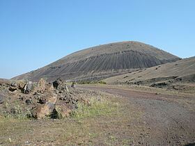
Kula is a volcanic field located in western Turkey. Kula field consists of a broad area of cinder cones and maars. It is the westernmost volcano of Turkey. The volcanic character of the area was recognized in antiquity, when it was named Katakekaumene (the burned lands) from the appearance of the environment, which was mostly suited for viticulture. Volcanism began in the Miocene and over three stages continued in the Holocene. It is associated with the presence of two neighbouring active (in 1969 last earthquake) graben structures. Most cones are of small size and one of them (Akcakoy Tepe) has its internal structure exposed. Total volume of the volcanic field extrusion is about 2,3 km3 and the lavas are rich in xenoliths. The plant succession on the lava fields and cones was subject of a study in 1974, which found that the vegetation is influenced both by climate factors such as temperature and precipitation and the orientation of the sides of the volcanoes in question. Footprints of prehistoric humans have been found in the area. The area is a Geopark recognized by UNESCO given the universal and scientific value.