
Local time Sunday 4:29 AM Province North Pyongan | Area 584 km² Population 139,337 (2008) | |
 | ||
Administrative divisions 1 ŭp, 5 rodongjagu, 22 ri Weather 0°C, Wind N at 3 km/h, 88% Humidity | ||
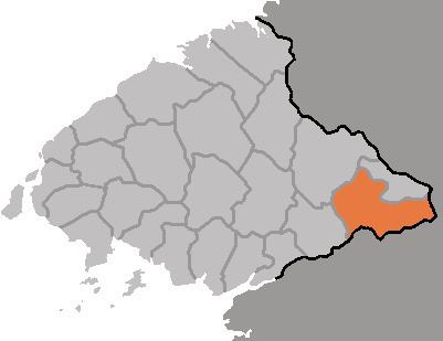
Kujang County is a kun, or county, in southeastern North P'yŏngan province, North Korea. It was created in 1952 from part of Nyŏngbyŏn county, as part of a nationwide reorganization of local government. It borders Nyŏngbyŏn on the west, Hyangsan and Unsan counties on the north, Nyŏngwŏn on the east, and Kaech'ŏn and Tŏkch'ŏn cities to the south.
Contents
- Map of Kujang South Pyongan North Korea
- Geography
- Administrative divisions
- Climate
- Economy
- Transportation
- References
Map of Kujang, South Pyongan, North Korea
Geography
The Myohyang Mountains stretch across the eastern part of Kujang. The highest point is Kalbong (칼봉, 1530 m) in the north. The Ch'ŏngch'ŏn River flows through the centre of the county, and the Kuryong River flows along its western flank. Due to the mountainous terrain, only 17% of the county's land is cultivated, while 74% is occupied by forestland.
Administrative divisions
Kujang county is divided into 1 ŭp (town), 5 rodongjagu (workers' districts) and 22 ri (villages):
Climate
The average annual temperature is 8.4 °C, with a January mean of -10.4 °C and an August mean of 24.2 °C. The average annual rainfall is 1300 mm, making for a comparatively cool and wet climate.
Economy
Zinc, coal, and mica are mined in the district. Factories produce cement and rail cars.
Transportation
The Manp'o, P'yŏngdŏk and Ch'ŏngnyŏn P'arwŏn lines of the Korean State Railway intersect in Kujang, along with various branch lines serving the county's mines. There is also a road grid.