
Country Thailand Postal code 46110 Area 739.2 km² Province Kalasin Province | Time zone ICT (UTC+7) Geocode 4605 Population 101,184 (2008) | |
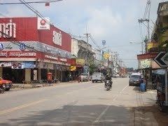 | ||
Kuchinarai (Thai: กุฉินารายณ์) is a district (amphoe) in the eastern part of Kalasin Province, northeastern Thailand.
Contents
Map of Kuchinarai District, Kalasin, Thailand
Geography
Neighboring districts are (from the west clockwise) Don Chan, Na Mon, Huai Phueng, Na Khu, and Khao Wong of Kalasin Province, Khamcha-i and Nong Sung of Mukdahan Province, Moei Wadi, Phon Thong, and Pho Chai of Roi Et Province.
Administration
The district is subdivided into 12 subdistricts (tambon), which are further subdivided into 142 villages (muban). There are two subdistrict municipalities (thesaban tambon) - Bua Khao and Kut Wa, each covering parts of the same-named tambon. There are further 12 tambon administrative organizations (TAO).
References
Kuchinarai District Wikipedia(Text) CC BY-SA