
Surface area 9.9 km (3.8 sq mi) Surface elevation 586 m Length 7.3 km Shore length 23.4 km | References NVE Area 9.9 km² Width 2.1 km | |
 | ||
Max. length 7.3 kilometres (4.5 mi) Max. width 2.1 kilometres (1.3 mi) Reference Norwegian Water Resources and Energy Directorate | ||
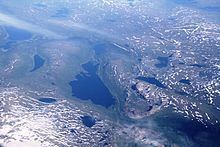
Krutvatnet (Southern Sami: Kruvhtegenjaevrie) is a lake in the municipality of Hattfjelldal in Nordland county, Norway. It lies about 7.5 kilometres (4.7 mi) east of the lake Røssvatnet and about 2 kilometres (1.2 mi) west of the border with Sweden. The Norwegian National Road 73 runs on the southern shore of the lake on its way from Hattfjelldal to Tärnaby in Sweden.
Map of Krutvatnet, 8690 Hattfjelldal, Norway
References
Krutvatnet Wikipedia(Text) CC BY-SA