
District Stade Time zone CET/CEST (UTC+1/+2) Area 30.03 km² Population 476 (31 Dec 2008) Dialling code 04779 | Elevation 2 m (7 ft) Postal codes 21732 Local time Saturday 1:36 PM Postal code 21732 Municipal assoc. Nordkehdingen | |
 | ||
Weather 7°C, Wind W at 37 km/h, 74% Humidity | ||
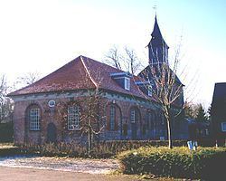
Krummendeich (in High German, in Low Saxon: Krummendiek) is a municipality in the district of Stade, in Lower Saxony, Germany.
Contents
Map of Krummendeich, Germany
History
Krummendeich belonged to the Prince-Archbishopric of Bremen. In the mid-16th century the inhabitants adopted Lutheranism. During the Leaguist occupation under Tilly (1628–1630), they suffered from attempts of re-Catholicisation.
In 1648 the prince-archbishopric was transformed into the Duchy of Bremen, which was first ruled in personal union by the Swedish and from 1715 on by the Hanoverian Crown. In 1807 the ephemeric Kingdom of Westphalia annexed the Duchy, before France annexed it in 1810. In 1813 the Duchy was restored to the Electorate of Hanover, which – after its upgrade to the Kingdom of Hanover in 1814 – incorporated the Duchy in a real union and the Ducal territory, including Krummendeich, became part of the Stade Region, established in 1823.