
Prominence 235 m | Elevation 3,457 m Mountain range Ötztal Alps Parent range Ötztal Alps | |
 | ||
Easiest route Via a marked path from the Martin Busch Hütte over the north ridge Similar Saykogel, Hintere Schwärze, Fineilspitze, Similaun, Fluchtkogel | ||
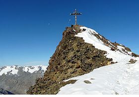
The Kreuzspitze is a mountain in the Schnalskamm group of the Ötztal Alps. It is one of the tallest peaks in its area.
Contents
Map of Kreuzspitze, 6458, Austria
Access roads and normal climbing route
To access the mountain you walk from Vent in the direction of Martin Busch hut which is at 2501 meters above the sea. This is a walk up, and it is normally free of snow in the summer time. Plan between 4 and 5 hours from Vent to the summit. From the village to the hut you will need 2 to 3 hours.
Vent is at around 1900 meters above the sea level and it is accessible by car following a rather good road from Solden (Soelden, Sölden).
References
Kreuzspitze (Ötztal Alps) Wikipedia(Text) CC BY-SA