Admin. region Stuttgart Elevation 470 m (1,540 ft) Area 48.46 km² Postal code 74594 Dialling code 07957 | Time zone CET/CEST (UTC+1/+2) Population 3,866 (31 Dec 2008) Local time Saturday 8:22 AM Administrative region Stuttgart | |
 | ||
Weather 6°C, Wind W at 37 km/h, 87% Humidity | ||
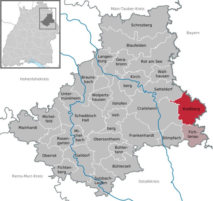
Kreßberg is a community in the district of Schwäbisch Hall in Baden-Württemberg in Germany.
Map of 74594 Kre%C3%9Fberg, Germany
There is no town or village with that name.
The community of Kreßberg consists of 33 separate villages:
Waldtann, Marktlustenau, Mariäkappel, Leukershausen, Bergbronn, Bergertshofen, Wüstenau, Riegelbach, Rötsweiler, Stegenhof, Schwarzenhorb, Hohenberg, Selgenstadt, Vötschenhof, Oberstelzhausen, Unterstelzhausen, Tempelhof, Hohenkreßberg, Gaisbühl, Schönbronn, Bräunersberg, Halden, Vehlenberg, Ruppersbach, Asbach, Haselhof, Waidmannsberg, Mistlau, Neuhaus, Sixenhof, Rudolfsberg, Schönmühle, Rotmühle.
The total population figure of Kreßberg is just 3788 (2010)
First settlements in the Kreßberg area were established between the 7th and the 9th century. The community in its current dimensions exists since 1 January 1973, when the former communities of Waldtann, Marktlustenau, Mariäkappel and Leukershausen were combined during the municipal reform.
