
Car plates LKS | Area 1,067 km² | |
 | ||
Gminas Total 10 (incl. 1 urban)KrasnystawGmina FajsławiceGmina GorzkówGmina IzbicaGmina KraśniczynGmina KrasnystawGmina Łopiennik GórnyGmina RudnikGmina Siennica RóżanaGmina Żółkiewka Website | ||
Krasnystaw County (Polish: powiat krasnostawski) is a unit of territorial administration and local government (powiat) in Lublin Voivodeship, eastern Poland. It was established on January 1, 1999, as a result of the Polish local government reforms passed in 1998. Its administrative seat and only town is Krasnystaw, which lies 50 kilometres (31 mi) south-east of the regional capital Lublin.
Contents
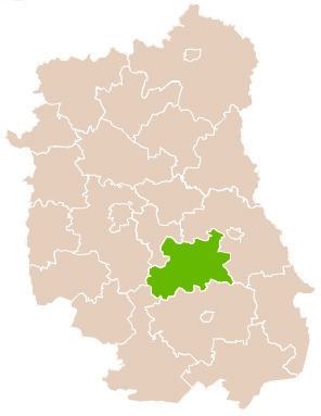
Map of Krasnystaw County, Poland
The county covers an area of 1,067.18 square kilometres (412.0 sq mi). As of 2006, its total population is 69,274, out of which the population of Krasnystaw is 19,434 and the rural population is 49,840.
Neighbouring counties
Krasnystaw County is bordered by Chełm County to the north-east, Zamość County and Biłgoraj County to the south, Lublin County to the west, and Świdnik County to the north-west.
Administrative division
The county is subdivided into 10 gminas (one urban and nine rural). These are listed in the following table, in descending order of population. (Until 2006 the county also included Gmina Rejowiec, which is now in Chełm County.)