
 | ||
The Kra Isthmus (Thai: คอคอดกระ, [kʰɔ̄ː kʰɔ̂ːt kràʔ]) is the narrowest part of the Malay Peninsula, in southern Thailand and Myanmar.
Contents
- Map of Isthmus of Kra Khron Sawi District Chumphon 86130 Thailand
- Geography
- History and culture
- Thai canal
- References
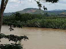
Map of Isthmus of Kra, Khron, Sawi District, Chumphon 86130, Thailand
Geography
The east part of the landbridge belongs to Thailand, while the west part belongs to the Tanintharyi division of Myanmar. To the west of the isthmus is the Andaman Sea, and to the east is the Gulf of Thailand.
The narrowest part, between the estuary of the Kra River and the Bay of Sawi near the city Chumphon has a width of 44 km (27 mi), and has a maximum elevation of 75 m (246 ft) above sea level.
The Kra Isthmus marks the boundary between two sections of the central cordillera, the mountain chain which runs from Tibet through the Malay peninsula. The southern part is called the Phuket chain, which is a continuation of the greater Tenasserim range, extending further northwards for over 400 km (250 mi) beyond the Three Pagodas Pass. The Titiwangsa Mountains are to the south, 45 km (28 mi) from Songkhla.
History and culture
On 8 December 1941 local time, just before the 7 December (Hawaii time) attack on Pearl Harbor, the Imperial Japanese Army landed near Songkhla, Thailand and Kota Bharu, Malaya, thus beginning the Pacific War, and launching both the invasion of Thailand and the Malayan campaign, the latter which culminated in the capture of Singapore.
Thai canal
The Thai canal is a proposal to join the Gulf of Thailand with the Andaman Sea. It was originally envisioned as crossing the isthmus. Today other locations to the south are being considered.