
Area 23.17 km² | Local time Saturday 4:15 PM | |
 | ||
Weather 7°C, Wind SW at 13 km/h, 82% Humidity | ||
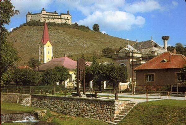
Krásnohorské Podhradie (Hungarian: Krasznahorkaváralja) is a village and municipality in the Rožňava District in the Košice Region of middle-eastern Slovakia.
Contents
Map of 049 41 Kr%C3%A1snohorsk%C3%A9 Podhradie, Slovakia
The town has a relative Hungarian majority and an Slovak and Roma minority [1]. The town is dominated by its namesake, the iconic Slovak Castle of Krásna Hôrka.
History
In historical records the village was first mentioned in 1322.
Geography
The village lies at an altitude of 369 metres and covers an area of 23.171 km². It has a population of about 2,480 people.
Culture
The village has a public library, a football pitch, and an iconic Slovak Castle of Krásna Hôrka. The castle was burned down in 2012.
References
Krásnohorské Podhradie Wikipedia(Text) CC BY-SA