
Country Ukraine District Skole Raion Elevation/(average value of) 622 m (2,041 ft) Area 650 km² | Province Lviv Oblast Established 1538 Time zone EET (UTC+2) | |
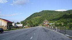 | ||
Kozyova — (Ukrainian: Козьова́) is a village located in Skole Raion (district) of Lviv Oblast (province) in Western Ukraine. It is located in the Ukrainian Carpathians within the limits the Eastern Beskids (Skole Beskids). Local government – Kozivska village council.
The first written mention of Kozyova which dates from the year 1538. The first settlers were hiding in the mountains from tatar-Mongol invasion.
Contents
Map of Koz'ova, Lvivska, Ukraine
Geography
The village is located along the Highway M06 (Ukraine) (). And is located along the Oriava River, is surrounded on of all parties by mountains and forests. The average height of the village is 622 metres (0.386 mi) above the sea level.
The village Kozyova is situated in the 128 kilometres (80 mi) from the regional center Lviv, 19 kilometres (12 mi) from the district center Skole, and 140 kilometres (87 mi) from Uzhhorod.
Attractions
In the village is an architectural monument of local importance of Skole Raion (Skole district). It is a wooden church of St. Nicholas, 1926.