
Time zone SAST (UTC+2) Local time Friday 11:21 PM | Wards 15 Municipal code EC108 | |
 | ||
Weather 17°C, Wind W at 6 km/h, 63% Humidity Points of interest Dolphin Beach Entertainment, Seal Point Lighthouse, Shell Museum, Bingo Royale, Humansdorp Museum | ||
The Kouga Local Municipality is located in the Eastern Cape of South Africa, approximately 80 km west of Port Elizabeth, and forms part of the Sarah Baartman District Municipality. Its territory includes the coastal zone between the Van Stadens River in the east and the Tsitsikamma River in the west, and stretches inland towards the Baviaanskloof Mountains in the north.
Contents
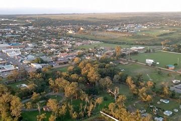
- Map of Humansdorp South Africa
- Topography and climate
- Towns and settlements
- Politics
- Main places
- References
Map of Humansdorp, South Africa
Regional access to the area is obtained via the N2 National Route from Port Elizabeth to Cape Town.
Topography and climate
The municipality is characterised by 3 main topographical regions:
The four main rivers in the area — the Kromme, Seekoei, Kabeljouws and Gamtoos — are all tidal rivers. The Kromme River and Gamtoos River are significant sources of water supply. Ground water forms another major component of domestic water supply for towns in the Kouga region, especially Humansdorp, Jeffreys Bay, St Francis Bay, Cape St Francis and Oyster Bay. Aquifers are also utilised in the agricultural sector for irrigation of pastures.
There are numerous areas of wetland adjacent to the region's rivers and on the coastal platform. These wetlands are extremely sensitive to disturbances such as agricultural activities and development. The wetlands accommodate high species diversity, and fulfil natural water purification and flood retention roles.
The climate of the Kouga region is subtropical, which makes the area conducive to a range of outdoor activities and various types of agricultural production. Rainfall varies between 650 mm per year (St Francis Bay area) to 400 mm (Gamtoos River Valley). The area is generally described as windy.
Towns and settlements
More than 70% of the population of the Kouga region lives in urban areas. Humansdorp, with over 24,000 residents, has an established infrastructure and acts as a regional service centre, supplying the surrounding agricultural communities and the coastal towns with commodities and services. Commercial and industrial activities of the region are centred in Humansdorp.
The coastal towns of Jeffreys Bay, St Francis Bay, Cape St Francis and Oyster Bay are well-established tourist destinations. Jeffreys Bay has a population of over 40,000 with an annual population growth rate of 2.5% or higher, making it one of the fastest growing towns in South Africa.
The urban areas of Hankey and Patensie, situated in the Gamtoos River Valley, provide important services to the surrounding high-density agriculture industry.
Other settlements in the Kouga region include: Andrieskraal, Aston Bay, Centerton, Gamtoos Mouth, Kruisfontein, Kwanomzamo, Loerie, Ocean View, Oyster Bay, Paradise Beach, Pellsrus, Ramaphoza Village, Sea Vista, Thornhill, Tokyo Sexwale, Umzamowethu and Weston.
Politics
The municipal council consists of twenty-nine members elected by mixed-member proportional representation. Fifteen councillors are elected by first-past-the-post voting in fifteen wards, while the remaining fourteen are chosen from party lists so that the total number of party representatives is proportional to the number of votes received. In the election of 3 August 2016 the Democratic Alliance (DA) won a majority of seventeen seats on the council, defeating the ANC, which previously controlled the council.
The following table shows the results of the 2016 municipal election.
Main places
The 2001 census divided the municipality into the following main places: