
District Tirunelveli Population 3,600 (2001) | Time zone IST (UTC+5:30) | |
 | ||
Kottakulam (Tamil: கொட்டாகுளம்) is a panchayat town in Tirunelveli district in the Indian state of Tamil Nadu. Kottakulam is aka Sumaitheernthapuram.
Contents
Map of Kottakulam, Tamil Nadu
Geography
Kottakulam is located at 8.966111°N 77.272778°E / 8.966111; 77.272778. It is located next to Ilanji. It is located 4 km away from the main town Tenkasi and also 3 km from the most beautiful Coutrallam falls.Kollam to Madurai National Highway 208 travels across this village. It is also bounded by two lake, West Kottakulam lake (Tamil : மேலக்குளம்) and East Kottakulam Lake and kundar( poosa durai ) (Tamil : கீழக்குளம்) and by a river, Kundaru (Tamil : குண்டாறு) (Vadakkaru).
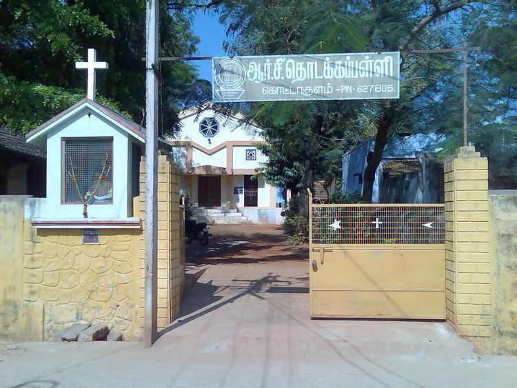
R.C. Church 'PUNITHA SEBASTHIYAR' ( St. Sebastian ) Church on control of Tenkasi ST.MICHEAL Church most powerful church. Village entrance near Bus stop Shithaai Amman Kovil (Tamil :சிற்றாற்றுவீரியம்மன் கோவில்) are important places in this village. Shithaai Amman Kovil (Tamil :சிற்றாற்றுவீரியம்மன் கோவில்) is located in center covered by beautiful farms from all sides. The other temples including sakthi (amman)kovil, Essaki Amman kovil (Tamil :இசக்கியம்மன் கோவில்) and Sudarvozhi Devan Temple.
Demographics
As of 2001 India census, Kottakulam had a population of 3600. Males constitute 51% of the population and females 49%.