
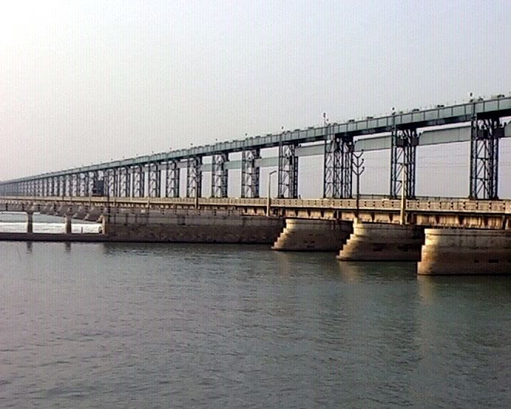
Official name Koshi Nepal Barrage Address Koshi River, Nepal Opened 1962 | Opening date 1956 Length 1,150 m Carry Mahendra Highway | |
 | ||
Location Sunsari and Saptari districts People's Republic of Nepal Operator(s) Water Resources Development Department of Indo-Nepal Government; Nepal Army and Nepal Police Impounds Koshi River (largest in Nepal in term of discharge) Impound Koshi River (largest in Nepal in term of discharge) Similar Bardiya National Park, Kankalini Temple, Dudh Kosi, Indrapuri Barrage, Ghaghara | ||
Koshi barrage nepal dipesh khatiwada
The Koshi Barrage is a Nepalese flood control sluice across the Koshi River near the International border with India. It was built between 1958 and 1962. It has 56 gates which are controlled by Nepal Army and officers imported from India. Downstream of the barrage near the border with India, Indian government has created an embankment which can create floods and other problems in Nepal.
Contents
The Koshi Tappu Wildlife Reserve is roughly 3–4 miles north of the Barrage.
2008 flood
In August 2008, the eastern embankments of the Koshi Barrage collapsed, several miles north of the Nepal-India border. The resulting flood left nearly 100,000 people homeless in Nepal and millions in Bihar, India.
High dam
The construction of a high dam near the Koshi Barrage has been considered. But Nepal government and the most of Nepalese people are not keen on constructing it.