
Founded 1836 Area 1,436 km² | Website www.kcgov.com Population 77,963 (2013) Unemployment rate 3.6% (Apr 2015) | |
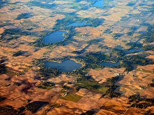 | ||
University Grace College and Theological Seminary Points of interest Lake Wawasee history, Winona Lake Park Department, Tri‑County Fish and Wildlife A, City of Warsaw Parks & R, Winona History Center Destinations Warsaw, Nappanee, Pierceton, Winona Lake, Lake Wawasee history | ||
Kosciusko county indiana
Kosciusko County (/ˌkɒskiˈʌskoʊ/ KOSS-kee-USS-koh) is a county located in the U.S. state of Indiana. Census 2010 recorded the population at 77,358. The county seat is Warsaw.
Contents
- Kosciusko county indiana
- Map of Kosciusko County IN USA
- Geographical features
- Adjacent counties
- Major highways
- Airport
- Newspapers
- Cities
- Towns
- Unincorporated communities
- Townships
- Climate and weather
- Government
- Elected Officials
- School districts
- Demographics
- References
Map of Kosciusko County, IN, USA
The county was formed in 1836. It was named after the Polish general Tadeusz Kościuszko who served in the American Revolutionary War and then returned to Poland. The county seat is named after Warsaw, the capital of Poland.
Geographical features
According to the 2010 census, the county has a total area of 554.39 square miles (1,435.9 km2), of which 531.38 square miles (1,376.3 km2) (or 95.85%) is land and 23.01 square miles (59.6 km2) (or 4.15%) is water.
Adjacent counties
Major highways
Airport
Newspapers
Times-Union
The Mail-Journal
The PAPER
Ink Free News
Cities
Towns
Unincorporated communities
Townships
Climate and weather
In recent years, average temperatures in Warsaw have ranged from a low of 15 °F (−9 °C) in January to a high of 82 °F (28 °C) in July, although a record low of −25 °F (−32 °C) was recorded in January 1985 and a record high of 103 °F (39 °C) was recorded in July 1976. Average monthly precipitation ranged from 1.45 inches (37 mm) in February to 4.51 inches (115 mm) in June.
Government
The county government is a constitutional body, and is granted specific powers by the Constitution of Indiana, and by the Indiana Code.
County Council: The county council is the legislative branch of the county government and controls all the spending and revenue collection in the county. Representatives are elected from county districts. The council members serve four-year terms. They are responsible for setting salaries, the annual budget, and special spending. The council also has limited authority to impose local taxes, in the form of an income and property tax that is subject to state level approval, excise taxes, and service taxes.
Board of Commissioners: The executive body of the county is made of a board of commissioners. The commissioners are elected county-wide, in staggered terms, and each serves a four-year term. One of the commissioners, typically the most senior, serves as president. The commissioners are charged with executing the acts legislated by the council, collecting revenue, and managing the day-to-day functions of the county government.
Court: The county maintains a small claims court that can handle some civil cases. The county also maintains a Circuit and Superior Court. The judge on each court is elected to a term of six years and must be a member of the Indiana bar.
County Officials: The county has several other elected offices, including sheriff, coroner, auditor, treasurer, recorder, surveyor, and circuit court clerk Each of these elected officers serves a term of four years and oversees a different part of county government. Members elected to county government positions are required to declare party affiliations and to be residents of the county.
Kosciusko County is part of Indiana's 3rd congressional district and in 2008 was represented by Mark Souder in the United States Congress. It is also part of Indiana Senate districts 9, 13, 17 and 18 and Indiana House of Representatives districts 18, 22 and 23.
Elected Officials
School districts
Demographics
As of the 2010 United States Census, there were 77,358 people, 29,197 households, and 20,740 families residing in the county. The population density was 145.6 inhabitants per square mile (56.2/km2). There were 37,038 housing units at an average density of 69.7 per square mile (26.9/km2). The racial makeup of the county was 93.3% white, 0.8% Asian, 0.7% black or African American, 0.3% American Indian, 3.4% from other races, and 1.4% from two or more races. Those of Hispanic or Latino origin made up 7.3% of the population. In terms of ancestry, 33.5% were German, 11.5% were Irish, 10.8% were English, and 8.2% were American.
Of the 29,197 households, 33.9% had children under the age of 18 living with them, 56.6% were married couples living together, 9.5% had a female householder with no husband present, 29.0% were non-families, and 23.9% of all households were made up of individuals. The average household size was 2.60 and the average family size was 3.07. The median age was 37.7 years.
The median income for a household in the county was $47,697 and the median income for a family was $56,305. Males had a median income of $44,358 versus $29,320 for females. The per capita income for the county was $24,019. About 7.0% of families and 10.0% of the population were below the poverty line, including 13.5% of those under age 18 and 5.2% of those age 65 or over.