
Length 40 km Source elevation 610 m | Basin size 624 km (241 sq mi) Basin area 624 km² Mouth Arabian Sea | |
 | ||
Main source Arikkankunni610 m (2,000 ft) | ||
Korapuzha also known as Elathur River is a short river of 40 km (25 mi), with a drainage area of 624 km2 (241 sq mi), flowing through the Kozhikode district of Kerala state in India. It is formed by the confluence of two streams, Akalapuzha and Punoor puzha which originate in the mountains of Wayanad district. The Korapuzha empties into the Arabian Sea at Elathur. The river and its main tributaries become tidal as they near the Arabian Sea. There is heavy boat traffic over the last 25 km (16 mi) of its course. It forms part of the West Coast Inland Navigation System.
Contents
Map of Korapuzha, Kerala
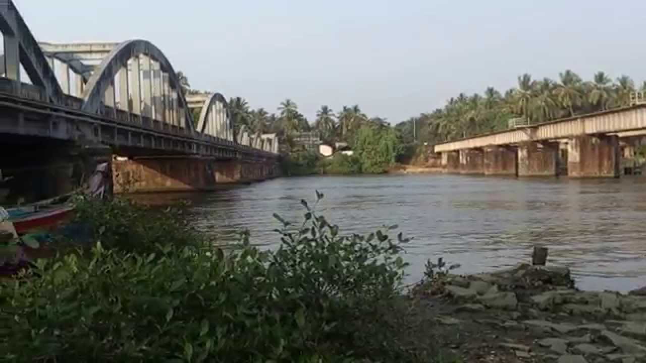
Korappuzha Bridge
This 480 metre bridge is the longest bridge in Kozhikode district. Completed in 2015, it has 13 spans. The surroundings are lush green and very photogenic.
The Korapuzha is generally considered as the cordon sanitaire between the North Malabar and South Malabar in the erstwhile Malabar District. Until the 20th century the Nair women of North Malabar crossing the Korapuzha and going south or marrying a person from South Malabar was considered a taboo and those who violated faced Bhrasht (Ostracism) and forfeiture of caste. Similarly some difference can be seen in Thiyya community as well. Land souteof Korapuzha is considered Thiruvithamkoor and North of Korapuzha is Kolathunadu.