
Country Vietnam Capital Kon Tum Calling code 60 | Region Central Highlands Time zone ICT (UTC+7) ISO 3166 code VN-28 | |
 | ||
Kon Tum Province lies in the Central Highlands region of Vietnam and shares borders with Laos and Cambodia. It has an area of 9,934 square km and a population of approximately 330,000. The economy is primarily agricultural.
Contents
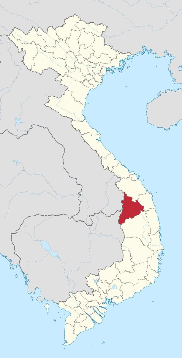
- Map of Kon Tum Province Vietnam
- Name
- Administrative divisions
- Geography
- Demographics
- Notable residents
- References
Map of Kon Tum Province, Vietnam
Name
The name Kon Tum comes from the name of a village of the Bahnar ethnic group. In the Bahnar language, kon means "village" and tum means "pool". Prior to the adoption of the Vietnamese alphabet in the 1920s, the name was rendered as 崑嵩.
Administrative divisions
Kon Tum is subdivided into 9 district-level sub-divisions:
They are further subdivided into 6 commune-level towns (or townlets), 83 communes, and 10 wards.
Geography
Neighboring provinces are Quảng Nam to the north, Quảng Ngãi to the east and Gia Lai to the south. The capital city is Kon Tum.
Demographics
Ethnic groups in Kon Tum Province include the Viet, Ba Na, Brau, Giẻ Triêng, Jarai, Rơ Măm, and Xo Dang.