
Country Cyprus Population 812 (2011) | ||
 | ||
Weather 10°C, Wind W at 8 km/h, 85% Humidity | ||
Komi Kebir (Greek: Κώμη Κεπήρ [[ˈkomi cʰeˈpir]]; Turkish: Büyükkonuk or Komikebir) is a village in Cyprus. It is located on the Karpas Peninsula, 33 kilometres (21 mi) north of Famagusta, and at an altitude of 90 metres (295 feet). Komi Kebir is under the de facto control of Northern Cyprus. As of 2011, it had a population of 812.
Contents
Map of B%C3%BCy%C3%BCkkonuk
Before 1974, Komi Kebir was inhabited both by Greek- and Turkish Cypriots. The Greek Cypriots constituted the majority. In 1973, an estimated 762 people were living in the village, of whom 200 were Turkish- and 562 Greek-Cypriot. 66 students were enrolled at the Greek-Cypriot primary school for the academic year of 1973–74.
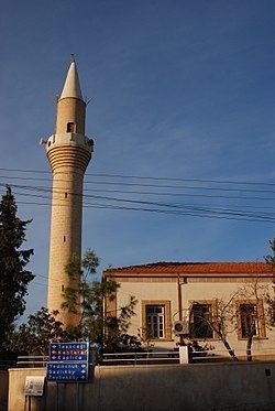
At the borders of the village, there are the churches of Saint George, Saint Afksentios and Saint Loukas. There are also the ancient churches of Panagia Kira, Saint George Parouzos, Saint Vasilios (in ruins), Saint Photiou (in ruins) and Saint Katherine (in ruins).
Twin towns – sister cities
Komi Kebir is twinned with: