
Country Population 13,846 | Capital | |
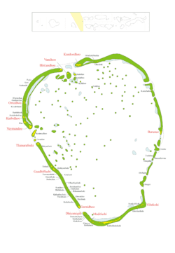 | ||
Map of Kolhumadulu Atoll
Kolhumadulu Atoll (also known as Thaa Atoll) is an administrative division of the Maldives. It corresponds to the natural atoll of the same name. The ancient name of the island was Kolhumaduva during the time of King Koimala who united all atolls of the Maldives under one kingdom for the first time.
Contents
- Map of Kolhumadulu Atoll
- Whale sharks in the night kolhumadulu atoll maldiviana february 2016
- Archaeology
- References
Traditionally, Maldivians call this atoll simply Kolhumadulu, without adding the word atholhu at the end. Thaa is the code letters assigned to the atoll and is sometimes used by tourists to refer to the atoll itself.
The waters surrounding this atoll are good fishing areas and some islands house fish processing plants.
Whale sharks in the night kolhumadulu atoll maldiviana february 2016
Archaeology
Kolhumadulu Atoll comprises thirteen inhabitant islands. They are; Buruni [N-1], Vilifushi [N-2], Madifushi [N-3], Dhiyamigili [N-4], Guraidhoo [N-5], Kadoodhoo [N-6], Vandhoo [N-7], Hirilandhoo [N-8], Gaadhifushi [N-9], Thimarafushi [N-10], Veymandoo [N-11], Kinbidhoo [N-12] and Omadhoo [N13]. There are important Buddhist archaeological remains in the island of Kinbidhoo, including a large ruined stupa. These were explored by the late Muhammad Ismail Didi. A report on the survey was published in the book Divehi Tārīkhah Au Alikameh.