
Isolation 12 kilometres (7.5 mi) Topo map 1219 IV Sykkylven Prominence 1,164 m | Parent range Sunnmørsalpene Elevation 1,432 m Mountain range Sunnmørsalpane | |
 | ||
Similar Skårasalen, Saudehornet, Slogen, Vassdalstinden, Grøtdalstindane | ||
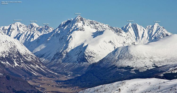
Kolåstinden is a mountain in Ørsta Municipality in Møre og Romsdal county, Norway. The 1,432-metre (4,698 ft) tall mountain is located where the Romedalen and Standaldalen valleys converge, about 5.5 kilometres (3.4 mi) west of the village of Store Standal and the Hjørundfjorden and it is about 12 kilometres (7.5 mi) northeast of the village of Ørsta.
Map of Kol%C3%A5stinden, 6150 %C3%98rsta, Norway
The summit is most easily reached from the area around Standalhytta på Standaleidet. It is easiest to reach the peak in the winter and spring on skis, in the summer ropes are recommended for the glacier crossing.
References
Kolåstinden Wikipedia(Text) CC BY-SA