
Country India District Bhojpur Website bhojpur.bih.nic.in Local time Friday 12:35 AM | Time zone IST (UTC+5:30) Population 19,925 (2001) ISO 3166 code ISO 3166-2:IN | |
 | ||
Weather 19°C, Wind SW at 2 km/h, 55% Humidity | ||
Koilwar (also spelt Koelwar) is a notified area in Bhojpur district in the Indian state of Bihar.
Contents
Map of Koilwar, Bihar 802160
Geography
Koilwar is located at 25.58°N 84.80°E / 25.58; 84.80. It has an average elevation of 39 metres (128 ft). It is situated on the bank of Son River.
Koilwar bridge
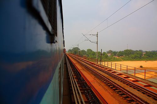
Koilwar Bridge is situated on the River Sone; its steel rail road bridge called as Abdul Bari Bridge made before independence, is shown in the film Gandhi. The Koelwar bridge across the Sone river was built by the British in 1900. A two lane road (NH 30) runs just under the rail tracks. Sand mining near the pillars of this old bridge has created structural problems recently.
Demographics
In the 2001 India census, Koilwar had a population of 19,925. Males constitute 61% of the population and females 39%. Koilwar has an average literacy rate of 55%, lower than the national average of 59.5%. Male literacy is 55%, female literacy 54%. 19% of the population is under 6 years of age.
Health
The village has a renowned TB hospital & Mental hospital
Education
Most villagers are working in government sectors. Good study environment provides this village to nearby villages. Many tuition and coaching centre are running successfully for a long time. Natural feeling comes while spending holidays here. Please do visit on 1 January every year on picnic spot on the bank of sone river.