
Time zone CET/CEST (UTC+1/+2) Population 2,916 (31 Dec 2008) | Elevation 233 m (764 ft) Postal codes 04655 Local time Thursday 7:40 PM | |
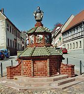 | ||
Weather 9°C, Wind SE at 6 km/h, 53% Humidity Points of interest Gnandstein Castle, Schwind‑Pavillon, Töpferbrunnen | ||
Kohren-Sahlis is a town in the Leipzig district, in the Free State of Saxony, Germany. It is situated 14 km southeast of Borna, and 31 km northwest of Chemnitz.
Contents
Map of Kohren-Sahlis, Germany
History
The first documented mention of Kohren-Sahlis was in 974.
Nazi Era
From 1 November 1942 to 14 April 1945 the children's home "Sonnenwiese" (Sunny Meadow), which was operated by the SS Lebensborn organization, was located in Kohren-Salis. Primarily children abducted from Norway were placed here before they were passed on for adoption to families loyal to the Nazi system .
Religion
Kohren-Sahlis is situated in a traditional Lutheran area. The Saint Gangulphus Church in Kohren-Sahlis, the Christ Church in Rüdigsdorf, the Village Churches in Altmörbitz and Gnandstein as well as the Chapel of Gnandstein Castle all belong to the Kohren Region Parish of the Evangelical-Lutheran Church of Saxony.
The few Catholics in Kohren-Sahlis belong to St. Joseph's Parish of Borna, Bishopric of Dresden-Meissen.