
Elevation 786 m (2,579 ft) Mountain type granite porphyry | ||
 | ||
The Kohlhaukuppe is a 786 metre high mountain in the Eastern Ore Mountains near Geising not far from the border with the Czech Republic.
Contents
HistoryEdit
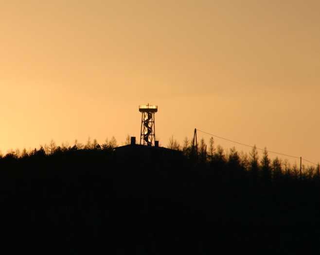
In older documents the mountain was just called Kuppe or Koppe which means "dome-shaped hill". When, in 1889, the House of Wettin celebrated its 800th anniversary and numerous festive events were held in the Kingdom of Saxony, the mountain was renamed the Wettinhöhe ("Wetten Heights") and a nine metre high, iron observation tower was built on the summit. It was inaugurated on 16 June 1889.
Next to the tower a bowery wooden building was erected as a restaurant. The mountain inn was only open in summer. After the business ground to a halt during the First World War, a new building with a massive cellar was built after the war's end that stood until 1933. In that year the mountain guesthouse was demolished at the behest of a customs inspector (Zollkommissar), because inter alia illegal leaflets had been distributed here.
After the Second World War the name Wettinhöhe was discontinued and the mountain was given its current name. In 1952 work began on rebuilding the inn. At the same time the tower was raised by 2 metres. This tower stood until 1995 and was then replaced by a steel design, that was similar to the original tower.
The inn has been open again since 1993. It holds evenings of "Myths and Magic" (Sagen und Magie). Because of the garlic dishes on the menu, the mountain is also known locally as the Knoblauchkuppe ("garlic dome").
Routes to the summitEdit
There is no direct access for private cars, the nearest option is pay car park by the Hüttenteich pond in Geising. From there two well-signed hiking trails run to the summit, either along the road or up a steeper, but shorter option uphill from the Anton Günther Stein.