
Length 4.4 km (2.73 mi) Highest elevation 1 m (3 ft) Elevation 1 m Province Sihanoukville Province | Coastline 13.4 km (8.33 mi) Area 6.7 km² | |
 | ||
Width 1.4–2.9 km (0.87–1.80 mi) | ||
Koh ta kiev
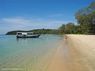
Koh Ta Kiev (Khmer: កោះតាគៀវ, “Ancestor Kiev’s Island” – named "Ile de la Baie" during the French colonial period) is the biggest of a small group of Cambodian islands, situated 4 km off Otres beach, Sihanoukville City and just 1 km off the coast of Ream National Park, Sihanoukville Province. Its predominantly forested area of 6.70 km2 (3 sq mi) is without any noticeable elevation.
Contents
Map of Koh Ta Kiev, Cambodia
The inhabitants of two villages run a Mango plantation. Apart from the Cambodian Navy, who maintains a small base with a port, no infrastructure exists.
Several beaches attract travelers and tourists. After many years of individual visitors, large scale resort development is in progress.
The island is accessible by ferry or speed-boat from Otres marina.
Koh ta kiev island in sihanoukville cambodia
References
Koh Ta Kiev Wikipedia(Text) CC BY-SA