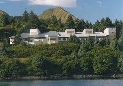
Incorporated September 24, 1963 Area 31,142 km² | Congressional district At-large Website www.kodiakak.us Population 14,135 (2013) | |
 | ||
Colleges and Universities Saint Herman's Orthodox Theological Seminary, Kodiak College Rivers Little Kanatak Creek, Jute Creek, Teresa Creek Points of interest Fort Abercrombie State Hist, Kodiak National Wildlife R, Alutiiq Museum, Erskine House, Kodiak Military History M | ||
Kodiak Island Borough is a borough in the U.S. state of Alaska. At the 2010 census, the population was 13,592. The borough seat is Kodiak.
Contents
Map of Kodiak Island, AK, USA
Geography
The borough has a total area of 12,022 square miles (31,140 km2), of which 6,550 square miles (17,000 km2) is land and 5,472 square miles (14,170 km2) (45.5%) is water. Most of the land area belongs to Kodiak Island, but a thin strip of coastal area on the western part of the Alaska Peninsula and other nearby islands (Afognak Island, Shuyak Island, Marmot Island, Raspberry Island, Little Raspberry Island, Whale Island, Spruce Island, Woody Island, Uganik Island, Sitkalidak Island, Tugidak Island, Sitkinak Island, Chirikof Island, and the Semidi Islands) are also in the borough. The waterway between the island and mainland is known as the Shelikof Strait. South of the island are the open waters of the Pacific Ocean, so the site is considered good for launching certain types of satellites. The Kodiak Launch Complex is ideal for putting satellites in Molniya and polar orbits.
Adjacent boroughs
National protected areas
Demographics
As of the census of 2000, there were 13,913 people, 4,424 households, and 3,256 families residing in the borough. The population density was 2 people per square mile (1/km²). There were 5,159 housing units at an average density of 1 per square mile (0/km²). The racial makeup of the borough was 59.69% White, 0.96% Black or African American, 14.58% Native American, 16.04% Asian, 0.79% Pacific Islander, 2.78% from other races, and 5.16% from two or more races. 6.10% of the population were Hispanic or Latino of any race. 13.10% reported speaking Tagalog at home, a language of the Philippines, while 5.28% speak Spanish.
There were 4,424 households out of which 45.90% had children under the age of 18 living with them, 59.70% were married couples living together, 8.80% had a female householder with no husband present, and 26.40% were non-families. 19.90% of all households were made up of individuals and 3.70% had someone living alone who was 65 years of age or older. The average household size was 3.07 and the average family size was 3.52.
In the borough the population was spread out with 32.40% under the age of 18, 8.30% from 18 to 24, 34.00% from 25 to 44, 20.40% from 45 to 64, and 4.80% who were 65 years of age or older. The median age was 32 years. For every 100 females there were 112.40 males. For every 100 females age 18 and over, there were 117.40 males.
