
Population 852 2011 Census Sovereign state United Kingdom Local time Thursday 10:50 AM | Civil parish Knodishall Postcode district IP17 1 | |
 | ||
Weather 13°C, Wind SW at 26 km/h, 72% Humidity | ||
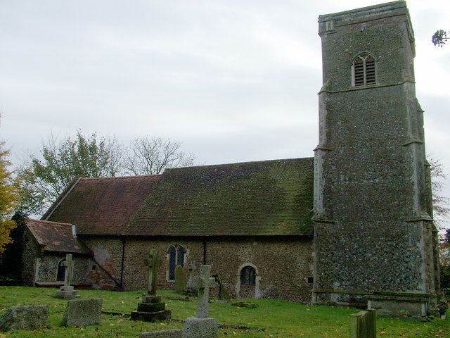
Knodishall is a village in Suffolk, England. The village is 3.5 miles (6 km) southeast of Saxmundham, and 1 mile (2 km) southwest of Leiston. Most of the village is now at Coldfair Green, with only a few houses remaining in the original village by the parish church of St Lawrence. There is a rectory to the west of Knodishall.
Contents
Map of Knodishall, Saxmundham, UK
According to the 2011 Census there were 418 males and 434 females living in the parish.
In the 1870's, Knodishall was described as:
"The parish contains also the village of Coldfair-Green, and the quondam parish of Buxlow; and is sometimes called Knodishall-cumBuxlow. Acres 1, 143. Real property, £3, 173. Pop., 442. Houses, 100. The property is divided among a few. There are clay and sand pits. The living is a rectory, united with the chapelry of Buxlow, in the diocese of Norwich."
Community
The village is dispersed and close to both Leiston and Aldeburgh. It has a village shop, the Butchers Arms pub, a smallholding, a garage and Coldfair Green Primary School. The village expanded with the building of a small housing estate in the mid 1980s.