
Population 40 (2005) Post town Diss | Sovereign state United Kingdom Postcode district IP22 District St Edmundsbury | |
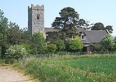 | ||
Knettishall is a village and civil parish in the St Edmundsbury district of Suffolk in eastern England. Located on the south bank of the River Little Ouse (the Norfolk-Suffolk border), in 2005 it had a population of 40. From the 2011 census the population of the village was not maintained and it is included in the civil parish of neighbouring Hopton.
Map of Knettishall, Diss, UK
The parish contains Knettishall Heath Country Park and the remains of RAF Knettishall, a World War II airfield.
References
Knettishall Wikipedia(Text) CC BY-SA