
Elevation 207 m Population 276 (2006) | Postal code 798 21 Area 5.33 km² | |
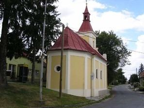 | ||
Klopotovice is a village and municipality (obec) in Prostějov District in the Olomouc Region of the Czech Republic.
Map of 798 21 Klopotovice, Czechia
The municipality covers an area of 5.33 square kilometres (2.06 sq mi), and has a population of 276 (as at 3 July 2006).
Klopotovice lies approximately 11 kilometres (7 mi) east of Prostějov, 17 km (11 mi) south of Olomouc, and 216 km (134 mi) east of Prague.
References
Klopotovice Wikipedia(Text) CC BY-SA