
Country Cyprus Time zone EET (UTC+2) Local time Thursday 7:48 AM | Population 1,551 (2001) | |
 | ||
Weather 7°C, Wind W at 14 km/h, 67% Humidity | ||
Klirou malounda waterdam cyprus
Klirou (Greek: Kλήρου, Turkish: Kliru) is a Historic Mining District and covers an area of 18.7 square kilometers. Situated in the northern foothills of the Troodos Mountains, 26 km southwest of Nicosia. The area was inhabited from the Late Bronze Age, by Arcadocypriot Greek settlers
Contents
- Klirou malounda waterdam cyprus
- Map of Klirou Cyprus
- Limassol to pafos with cycling club klirou cyprus 141115
- History
- References
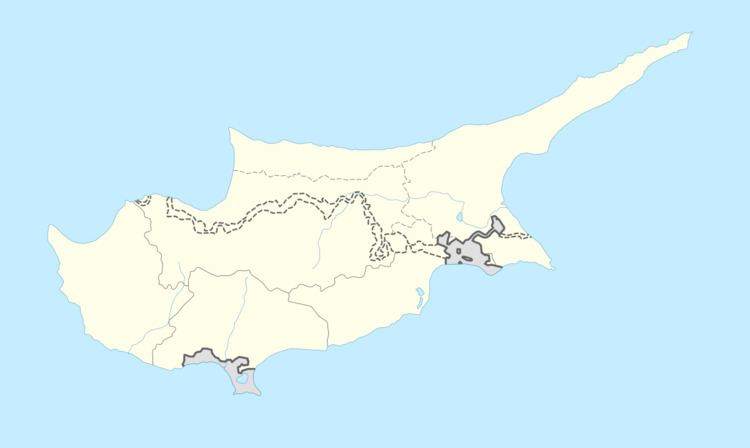
Map of Klirou, Cyprus
Limassol to pafos with cycling club klirou cyprus 141115
History
Klirou was an integral part of Ancient Tamassos Kingdom as it was a copper production district, dotted with hundreds of mines and dozens of smelting - furnace sites. According to Strabo the Tamasos kingdom had silver mines at the Kouloupas area. During Roman times, the mining industry in Cyprus was run by the Procurator (Roman). From the 2nd to 5th century Klirou village wasn’t a village as we now know, but a complex of more than 10 villages with a mixed population, mostly of Greek and Jewish within the districts. In the centre of Klirou there existed a 3 kilometers long underground water supply tunnel and two large water storage units, on the site known as Λίμνή (lake). There is evidence of ancient burial pits containing lots of skulls, which could indicate mass war graves dating back to Roman times. Some sources say that, the Jewish villages were abandoned or destroyed during Kitos War.
It appears that its name, taken during the period of transition to Christianity, from the clerics accompanying the Roman army and station in Klirou at 390 A.C preaching Christianity, and observing the anti-pagan’s laws. During that period, all people living in the area, had to go to Klirou and declare themselves as Christians, to have rights in court law, property, and possessions. As they use to say "we are going to the see the clerics" (Κληρικους). Hence the name Klirou came into existence.
According to the local version of myth, at around (650 - 700 AD). A military unit of Arabs, with mission to conquest Pitsilia, had been decimated by a severe hail storm in the area Klirou - Fikardou. The commander and few soldiers, sought refuge in the small chapel of Lachni. The infidel officer sensed the connection of the storm with the sanctity of the place and made a vow to rebuild the chapel, if the storm calms, which was done. The same source reports that this military officer, although later was promoted to an advisor of Umayyad Caliphate in Syria, rebuilt and often visited the chapel.
At the Frankish (Lusignan Dynasty) (1200-1490) Klirou was Montolipho’s family fiefdom. Amongst (1294-1310) Simon de Montolipho was one of the leaders of the Templars in Cyprus. In 1308 the Pope ordered the arrest of all Templars, to the island. Amalric, Prince of Tyre was ruling Cyprus at the time and had overthrown his brother Henry II of Jerusalem (and Cyprus), with the help of the Templars. The Templars blamed Amalric for the arrests and commissioned Simon for the job. Simon manned his team with trusted men from klirou and dressed as stable servants, ambushed the regency in the village of Pentageia disarming his guards. Simon in a duel, beheaded the regency and removed his royal necklace. Simon’s accomplices demanded the regency’s ring and Simon de Montolipho cut the right hand of Amalric and they took it with them. Recognizing the services offered to her son, his mother Laura, gifted in seven families land estates, which became to be known as Laoura in Klirou