
Country Canada Census division 10 Time zone MST (UTC−7) Elevation 670 m Local time Wednesday 5:09 PM | Founded 1905 Area 154 ha Population 925 (2016) Province Alberta | |
 | ||
Weather 4°C, Wind N at 10 km/h, 64% Humidity | ||
Amazing acreage short drive to lloydminster or kitscoty
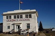
The Village of Kitscoty in Alberta is situated at the junction of Highway 16 (Yellowhead Highway) and Highway 897 (the proposed link to Cold Lake). The village is located approximately midway between Edmonton and Saskatoon (225 km (140 mi) and 295 km (183 mi) respectively). In addition, the village is within short commuting distance of Lloydminster. The CN railway tracks also pass through Kitscoty. The surrounding County of Vermilion River's municipal office is located in Kitscoty.
Contents
- Amazing acreage short drive to lloydminster or kitscoty
- Map of Kitscoty AB Canada
- History
- Demographics
- Education
- References
Map of Kitscoty, AB, Canada
Kitscoty is located in a prime agricultural area which has much heavy oil activity, both of which provide employment opportunities for the residents.
History
The first settlers came to the district in 1905, and was incorporated as a Village in 1911. Kitscoty originally served a trading area stretching from Cold Lake in the north to the Battle River in the south. Kitscoty is named after a famous cromlech, 3 large stones in a tripod arrangement, found near a settlement in England known as Kit's Coty House.
Demographics
In the 2016 Census of Population conducted by Statistics Canada, the Village of Kitscoty recorded a population of 925 living in 317 of its 337 total private dwellings, a 7000930000000000000♠9.3% change from its 2011 population of 846. With a land area of 1.51 km2 (0.58 sq mi), it had a population density of 612.6/km2 (1,586.6/sq mi) in 2016.
The population of the Village of Kitscoty according to its 2016 municipal census is 976, a 6999900000000000000♠0.9% change from its 2013 municipal census population of 967.
In the 2011 Census, the Village of Kitscoty had a population of 846 living in 300 of its 316 total dwellings, a 19.3% change from its 2006 population of 709. With a land area of 1.54 km2 (0.59 sq mi), it had a population density of 549.4/km2 (1,422.8/sq mi) in 2011.
In 2006, Kitscoty had a population of 709 living in 263 dwellings, a 5.7% increase from 2001. The village has a land area of 1.54 km2 (0.59 sq mi) and a population density of 460.7 inhabitants per square kilometer.
Education
There is an elementary school and a junior/senior high school within the village.