
Founded January 16, 1857 Area 1,466 km² | Named for Chief Kitsap Website www.kitsapgov.com Population 253,968 (2013) Unemployment rate 5.3% (Apr 2015) | |
 | ||
Points of interest USS Turner Joy, Puget Sound Navy Mus, Hood Canal, Naval Undersea Museum, Illahee State Park Colleges and Universities Olympic College, Northwest College of Art & Desi, Pinchot University, Everest College‑Bremerton | ||
Kitsap County is located in the U.S. state of Washington. As of the 2010 census, its population was 251,133. Its county seat is Port Orchard, and its largest city is Bremerton. The county was formed out of King County, Washington, and Jefferson County, Washington on January 16, 1857 and is named for Chief Kitsap of the Suquamish Tribe. Originally named Slaughter County, it was soon renamed.
Contents
- Map of Kitsap County WA USA
- History
- Geography
- Adjacent counties
- 2010 census
- Politics
- Board of County Commissioners
- 23rd Legislative District
- 26th Legislative District
- 35th Legislative District
- Post secondary education
- Public schools
- Cities
- Transportation
- Notable people
- In popular culture
- References
Map of Kitsap County, WA, USA
Kitsap County comprises the Bremerton-Silverdale, WA Metropolitan Statistical Area, which is also included in the Seattle-Tacoma, WA Combined Statistical Area.
The United States Navy is the largest employer in the county, with installations at Puget Sound Naval Shipyard, Naval Undersea Warfare Center Keyport, and Naval Base Kitsap (which comprises former NSB Bangor, and NS Bremerton).
Kitsap County is connected to the eastern shore of Puget Sound by Washington State Ferries routes, including the Seattle-Bremerton Ferry, Southworth to West Seattle via Vashon Island, Bainbridge Island to Downtown Seattle, and from Kingston to Edmonds, Washington.
History
When the Washington Territory was organized in 1853, the Kitsap Peninsula was divided between King County to the east and Jefferson County to the west. Official public papers were required to be filed at the county seat, which meant Peninsula business people had to travel to either Seattle or Port Townsend to transact business. On the understanding that they would "bring home a new county," area mill operators George Meigs and William Renton supported the candidacies to the Territorial Legislature of two employees from their respective mills: Timothy Duane Hinckley from Meigs' and S.B. Wilson from Renton's.
Upon arrival in Olympia, the two men introduced bills to create a new county, to be named "Madison". Representative Abernathy from Wahkiakum County proposed an amendment to name it "Slaughter", in recognition of Lt. William Alloway Slaughter, who had been killed in 1855 in the Yakima War. The bill passed as amended. It was signed by Governor Isaac Stevens on January 16, 1857. The county seat would be located in Meigs's mill town at Port Madison.
In Slaughter County's first election on July 13, 1857, voters were given the opportunity to rename the county. The options were "Mill", "Madison" or "Kitsap". Slaughter was not one of the options. Kitsap won by an overwhelming majority.
Geography
According to the U.S. Census Bureau, the county has a total area of 566 square miles (1,470 km2), of which 395 square miles (1,020 km2) is land and 171 square miles (440 km2) (30%) is water. It is the fourth-smallest county in Washington by land area and third-smallest by total area.
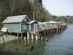
In addition to occupying most of the Kitsap Peninsula, Kitsap County includes both Bainbridge Island and Blake Island. According to Puget Sound Partnership, Kitsap county has over 250 miles (400 km) of saltwater shoreline.
The portion of the county north of Silverdale is often referred to as North Kitsap, and the portion south of Bremerton as South Kitsap.
Adjacent counties
2010 census
As of the 2010 United States Census, there were 251,133 people, 97,220 households, and 65,820 families residing in the county. The population density was 635.9 inhabitants per square mile (245.5/km2). There were 107,367 housing units at an average density of 271.9 per square mile (105.0/km2). The racial makeup of the county was 82.6% white, 4.9% Asian, 2.6% black or African American, 1.6% American Indian, 0.9% Pacific islander, 1.6% from other races, and 5.8% from two or more races. Those of Hispanic or Latino origin made up 6.2% of the population. In terms of ancestry, 21.3% were German, 14.4% were Irish, 13.8% were English, 7.1% were Norwegian, and 4.2% were American.
Of the 97,220 households, 31.7% had children under the age of 18 living with them, 53.2% were married couples living together, 10.2% had a female householder with no husband present, 32.3% were non-families, and 25.2% of all households were made up of individuals. The average household size was 2.49 and the average family size was 2.97. The median age was 39.4 years.
The median income for a household in the county was $59,549 and the median income for a family was $71,065. Males had a median income of $52,282 versus $38,499 for females. The per capita income for the county was $29,755. About 6.1% of families and 9.4% of the population were below the poverty line, including 11.8% of those under age 18 and 5.3% of those age 65 or over.
Politics
Kitsap County is generally been considered to be a relatively Democratic area. In the 2016 U.S. presidential election, Democrat Hillary Clinton received 49.05% of the vote to Republican Donald Trump's 38.07%.
On mainland Kitsap County, politics are dominated by working-class Bremerton, which casts moderate margins for Democratic candidates. However, population shifts have resulted in Bremerton playing less of a role in politics, and unincorporated Kitsap County is a mix of battleground areas and staunchly Republican areas. Non-Bremerton parts of incorporated mainland Kitsap County vary, with Silverdale having become a Republican stronghold, Poulsbo marginally Democratic, and Port Orchard consistently election Republican candidates over democrats.
Democrats normally carry the Indian reservations of the area by wide margins; the area around Little Boston (part of the S'Klallam Indian Reservation) regularly gives Democratic candidates landslides of 10-to-1. The multicultural Port Madison Indian Reservation (across from Bainbridge Island) also gives Democrats victories of upwards of 3-to-1.
Democratic electoral control of Kitsap County is partly due to Bainbridge Island, which casts a significant number of votes and is almost 4-to-1 Democratic. Bainbridge Island's growth and Democratic trend offsets population losses of Bremerton, generally resulting in the county as a whole being stable but very close.
The Kitsap County Auditor Website has detailed election results from 1998 to the present. County area political trends can be tracked by analyzing the election precinct data.
Board of County Commissioners
Robert Gelder (D) - District #1, North Kitsap Gelder was appointed to replace Steve Bauer, who resigned in March 2011.
Charlotte Garrido (D) - District #2, South Kitsap Garrido was re-elected in Nov. 2012, when she defeated Linda Simpson. Commissioner Garrido previously served on the county commission from 1997 to 2000 and again from 2009 to 2012
Ed Wolfe (R) - District #3, Central Kitsap
Wolfe became the first elected Republican county commissioner since Jan Angel was elected South Kitsap Commissioner in 2004. Wolfe replaced Linda Streissguth (D), who had been appointed in January 2014 to replace Josh Brown (D). Prior to his election, he was a well-known local attorney with years of successful litigation and business law experience. Commissioner Wolfe served with the U.S. State Department during the Ronald Reagan and George H.W. Bush administrations as Deputy Assistant Secretary of State for Oceans and Fisheries Affairs with the rank of ambassador.
23rd Legislative District
Bainbridge Island, East Bremerton, Poulsbo and Silverdale
26th Legislative District
Bremerton, Gig Harbor and Port Orchard
35th Legislative District
Bremerton, Shelton and Mason County
Post-secondary education
Public schools
Cities
Transportation
Kitsap County is connected to the eastern shore of Puget Sound by Washington State Ferries routes, including the Seattle-Bremerton Ferry, Southworth to West Seattle via Vashon Island, Bainbridge Island to Downtown Seattle, and from Kingston to Edmonds, Washington.
The county is connected to Jefferson County and the Olympic Peninsula to the west by the Hood Canal Bridge.
A 48-mile long government-owned rail line, the Bangor-Shelton-Bremerton Navy Railroad, runs through the county. It is a branch off the Puget Sound and Pacific Railroad, with its junction at Shelton. At the Bremerton Junction near Gorst a spur follows Highway 3 along the shore of the Sinclair Inlet terminating at the Puget Sound Naval Ship Yard, the other follows Highway 3 along the western shore of Dyes Inlet, servicing Bangor Naval Submarine Base. The Navy had originally intended to use armored trains to transport nuclear missiles to Bangor for the Trident submarines but protesters and a series of court decisions derailed the plan. Today the railroad is primarily used to transport scrap from PSNS.
Notable people
In popular culture
Walking Tall with The Rock and Johnny Knoxville was based in Kitsap County, and the City of Port Orchard is the basis for the fictional community of Cedar Cove in the books by Debbie Macomber.