
- Flower Cosmos (flower) Area 17.55 km² | - Tree Sakura Phone number 052-911-3131 Population 164,619 (Feb 2012) | |
 | ||
Region Tōkai regionChūbu region Time zone Japan Standard Time (UTC+9) | ||
Kita Ward (北区, Kita-ku) is one of the 16 wards of the city of Nagoya in Aichi Prefecture, Japan. As of 2012, the ward had an estimated population of 164,619 and a population density of 9,380 persons per km². The total area was 17.55 km².
Contents
- Map of Kita Ward Nagoya Aichi Prefecture Japan
- Geography
- Surrounding municipalities
- History
- Economy
- Railroads
- Highways
- Local attractions
- References
Map of Kita Ward, Nagoya, Aichi Prefecture, Japan
Geography
Kita Ward is the north of the center of the city of Nagoya.
Surrounding municipalities
History
Kita Ward was founded in 1944. Its area was expanded in 1946 with an addition from Higashi-ku and again in 1951 with an addition from Naka-ku. In 1955, the village of Kusunoki, formerly part of Nishikasugai District was annexed by Nagoya city, and joined to Kita Ward.
Economy
Kita Ward is largely a regional commercial center and bedroom community for central Nagoya.
Railroads
Highways
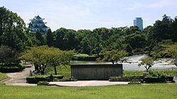
Local attractions
References
Kita-ku, Nagoya Wikipedia(Text) CC BY-SA