
Time zone CET (UTC+1) Area 65.81 km² Local time Wednesday 10:06 PM | County Csongrád County Postal code 6775 Population 4,210 (2002) Area code 62 | |
 | ||
Weather 9°C, Wind NW at 11 km/h, 73% Humidity | ||
Kiszombor is a village in Csongrád County, in the Southern Great Plain region of southern Hungary.
Contents
Map of Kiszombor, Hungary
Geography
It covers an area of 65.81 km2 (25 sq mi) and has a population of 4210 people (2002).
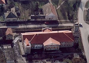
It is an agricultural village, near the river Maros. With more than its 750 years history it has some antic buildings, for example the Castle Ronay, and the Rotunda which is a church with circle-shaped sketch. There are some beautiful wall-paintings in Gothic style which were painted in the 14th century. The church itself was built in Romanesque style in the 13th century.
There is a border-crossing point into Romania near the village, where the first village is Cenad.
There is a village-festival on the third weekend of September every year. Many Hungarian artists appear, play, sing, dance and so on.
Sightseeing for visitors
In the village we can see an old architectural heritage from the romanesque art: the church. It consists of two parts. The older is the rotunda built with six sections. The younger is the village church. The rotunda has two other relatives of this type in the Carpathian Basin: Gerény and Karcsa.