
Local time Wednesday 8:23 PM | Area 8.4 km² | |
 | ||
Weather 11°C, Wind W at 2 km/h, 93% Humidity | ||
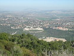
Caf anin in kiryat tiv on israel
Kiryat Tiv'on (Hebrew: קִרְיַת טִבְעוֹן, also Qiryat Tiv'on; Arabic: كريات طبعون) is a town in the Haifa District of Israel, in the hills between the Zvulun (Zebulon) and Jezreel valleys. Kiryat Tiv'on is situated 15 kilometres (9.3 mi) southeast of Haifa, on the main road to Nazareth. Kiryat Tiv'on is the result of the municipal merger of several older settlements, Tiv'on (est. 1947), Elro'i (est. 1935), Kiryat HaRoshet (est. 1935) and Kiryat Amal (est. 1937). On the outskirts of Tiv'on is a Bedouin township called Basmat Tab'un. In 2015 it had a population of 17,859.
Contents
- Caf anin in kiryat tiv on israel
- Map of Kiryat Tivon Israel
- Ottoman era
- British Mandate era
- State of Israel
- Education
- Landmarks
- Notable residents
- Twin towns sister cities
- References
Map of Kiryat Tiv'on, Israel
Ottoman era
In 1859, the village of Tubaun was estimated to have a tillage of 22 feddans. In 1875, Victor Guérin found that the village had 200 inhabitants.
In 1881, the Palestine Exploration Fund's Survey of Western Palestine (SWP) described Tubaun as a small adobe village, on high ground, at the edge of the wood.
British Mandate era
The 1922 census of Palestine showed that Tubun had 151 inhabitants, all Muslim. In 1925 a Zionist organisation purchased 30 feddans in Kiskis (present Alonim) and Tabon (present Kiryat Tiv'on) from the Sursuk family of Beirut. At the time, there were 36 families living there. In the 1931 census Tabun had a population of 239, still all Muslim, in a total of 48 houses. From 1931, and lasting several years, the Jewish Agency struggled to evict the tenant farmers from Tabaun, from the land which was to become Tivon.
By 1945, al Tivon (Alonim) (previously Qusqus Taboun) had 370 Muslim and 320 Jewish inhabitants, with a total land area of 5,823 dunams. Of this, 141 dunams were used for plantations and irrigable land, 2,038 for cereals, while 3,644 dunams were classified as non-cultivable land land.
State of Israel
Kiryat Tiv'on was established in 1958 merging three small villages Tiv'on (founded in 1947), Kiryat Amal (founded in 1937) and Elro'i (founded in 1935). Kiryat Haroshet, founded by a rabbi from Jablona, Poland who settled there with his followers in 1935, became part of Kiryat Tiv'on in 1979.
Tiv'on was built on land owned by a British Jewish couple who bought the land in early 1945. It was later developed by the Jewish National Fund based on an urban plan drawn up by Alexander Klein, a Russian Jewish architect who was commissioned by the Jewish National Fund.
The symbol of Kiryat Tiv'on is the cyclamen, a flower that grows between the rocks, reflecting the town's appreciation of nature and its efforts to preserve the landscape and safeguard the environment.
Education
Landmarks
The town is best known for the national park, Beit She'arim, which borders it on the southwest. Beit Shearim was an important Jewish spiritual center and necropolis during the Roman period, and was once the seat of the Sanhedrin.
Notable residents
Twin towns – sister cities
Kiryat Tiv'on is twinned with: