
Population 462 (2011) Civil parish Kirkby Overblow Dialling code 01423 | OS grid reference SE325492 Local time Tuesday 5:57 PM UK parliament constituency Skipton and Ripon | |
 | ||
Weather 11°C, Wind W at 19 km/h, 64% Humidity | ||
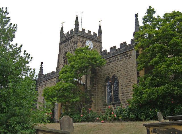
Kirkby Overblow is a village and civil parish in the Harrogate district of North Yorkshire, England. It is situated between Wetherby and Harrogate and lies to the west of Sicklinghall and the east of Leeds Bradford International Airport. It has a church called All Saints [1] and a Church of England primary school affiliated with the church [2]. There are two pubs in Kirkby Overblow. The Shoulder of Mutton, which boasts a large beer garden, and the Star and Garter. Kirkby Overblow has a bus stop, but no railway station or post office.
Contents
Map of Kirkby Overblow, Harrogate, UK
History
The first written reference to Kirkby Overblow appears in the Domesday Book, where it appears as Cherchebi. The Kirkby part of the name is a common prefix, simply meaning a settlement by a church, while Overblow is a corruption of Oreblow, a reference to the village's iron-smelting past.
Kirkby Overblow was a large ancient parish, which included the townships of Kearby with Netherby (including the hamlets of Kearby and Netherby), Rigton (which later became North Rigton), Sicklinghall and Stainburn. All these places became separate civil parishes in 1866.
Climate
Climate in this area has mild differences between highs and lows, and there is adequate rainfall year round. The Köppen Climate Classification subtype for this climate is "Cfb" (Marine West Coast Climate/Oceanic climate).