
 | ||
The King Country (Māori:Te Rohe Pōtae or Rohe Pōtae o Maniapoto) is a region of the western North Island of New Zealand. It extends approximately from the Kawhia Harbour and the town of Otorohanga in the north to the upper reaches of the Whanganui River in the south, and from the Hauhungaroa and Rangitoto Ranges in the east to near the Tasman Sea in the west. It comprises hill country, large parts of which are forested.
Contents
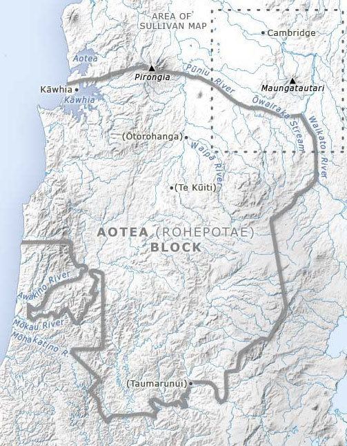
The term "King Country" dates from the New Zealand Wars of the 1860s, when colonial forces invaded the Waikato and forces of the Māori King Movement withdrew south of what was called the aukati, or boundary, a line of pa alongside the Puniu River near Kihikihi. Land behind the aukati remained native territory, with Europeans warned they crossed it under threat of death.
Government
The King Country per se is not an entity in local government. It forms part of two local government Regions, Waikato and Manawatu-Wanganui, and all or part of four districts: Otorohanga, Ruapehu, Taupo and Waitomo.
Geography
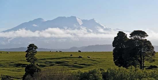
The King Country (a.k.a. Western Uplands) is largely made up of rolling hill country, including the Rangitoto and Hauhungaroa Ranges. It includes extensive karst regions, producing such features as the Waitomo Caves.
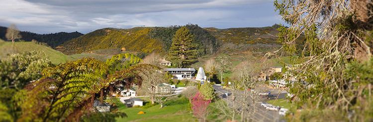
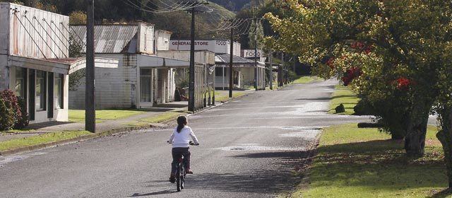
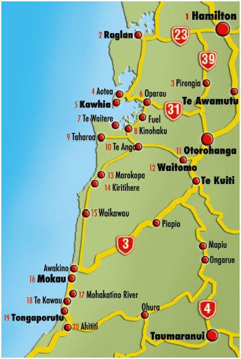
The area is largely rural and sparsely settled, with no cities or large towns. The most significant townships are the rural service centres of Te Kuiti (in the north) and Taumarunui (in the south).
Economy
The greater part of the region's economy is involved in farming (especially pastoral farming) and forestry, with some supporting services. There are some areas of tourist significance, such as Waitomo Caves. The King Country also contains areas of conservation estate, especially Pureora Forest Park.
From 1966 to 31 March 2010, King Country Radio (with the call sign 1ZU) operated from Taumarunui.
History
Prior to European settlement, the area was occupied by various Māori iwi, especially Ngāti Maniapoto, Ngāti Tama, and Ngāti Tuwharetoa.
In July 1863, Governor Sir George Grey ordered the invasion of the Waikato by British troops, with support from small numbers of loyal Māori. The invasion was aimed at crushing Kingite power that was seen as a threat to British authority, and also at driving Waikato Māori from their territory in readiness for occupation and settlement by Europeans.
Heavily outnumbered and disadvantaged by superior firepower, the Kingite forces retreated southwards from the Waikato after the battle at Ōrākau in April 1864, eventually being forced to flee to Maniapoto land, later called the King Country.
At this time, the region received a Māori name, Rohe pōtae. This name translates as "Area of the Hat", and is said to have originated when the second Māori King Tāwhiao put his white top hat on a large map of the North Island and declared that all land covered by the hat would be under his mana (or authority).
Heavy British losses at the battle of Gate Pā at Tauranga in April 1864 prompted General Duncan Cameron to abandon plans for further military campaigns in the Waikato area, and Grey and the colonial government were forced to accept this decision. The King Country, mountainous, poor and isolated, was not an attractive conquest. King Tāwhiao and his followers were able to maintain a rebel Māori monarchy in exile and a refuge for rebel Māori opposed to the government for more than a decade although living conditions were very poor. This may be partly due to the large influx of about 3,500 Waikato people who swamped the resources of the approximately 800 Maniapoto living in the rohe.
On 15 May 1872 Te Kooti, on the run from government forces, crossed the Waikato River and entered the territory as supplicant and was granted asylum.
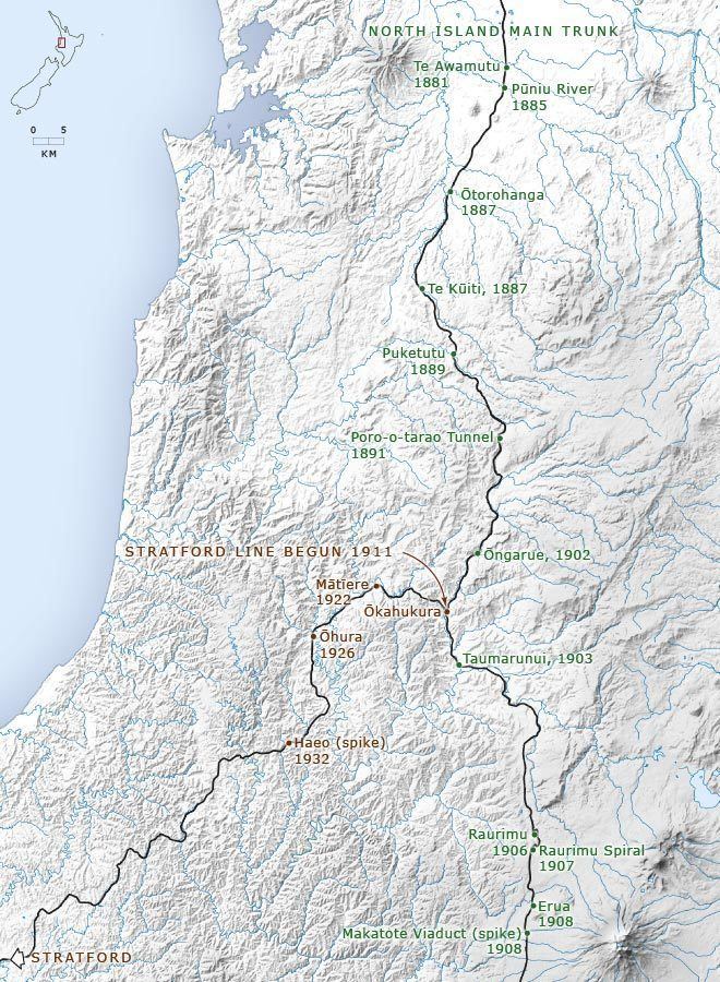
In 1881, as a result of ongoing friction with his hosts over the question of land sales, and a general amnesty being granted to the rebels, Tāwhiao emerged and laid down the King Movement's arms. After successful negotiations between the government, Wahanui, Rewi and Taonui, including a pardon for Te Kooti by 1883 the King Country was made accessible to Europeans. It was opened to road surveying, and the start of the Main Trunk Line - but with a prohibition on the sale of alcohol throughout the district.
Construction of the railway began in 1885, and finished in 1908, with the completion greatly improving transport and communications in the King Country, promoting settlement and farming in the area - as well as assisting in the growth of rural service towns such as Taumarunui which was an important railway depot until the 1950s. The alcohol ban lasted until 1953 - as a young man, John A. Lee was jailed for smuggling alcohol into the area around 1910.
Sport
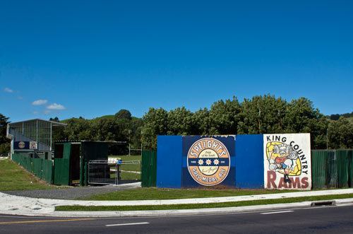
The King Country Rugby Football Union has produced several Rugby union players who became All Blacks: Bill Phillips, Kevin Boroevich, John McLean, Ron Bryers, Colin Meads, Stan Meads, Graham Whiting, Joe Ratima,
The North King Country soccer team plays in a yellow and blue strip. It is based in Otorohanga.