
Chapman code KCD | Area 984.2 km² | |
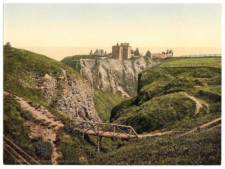 | ||
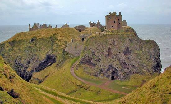
Ancestry genealogy photographs stonehaven kincardineshire scotland
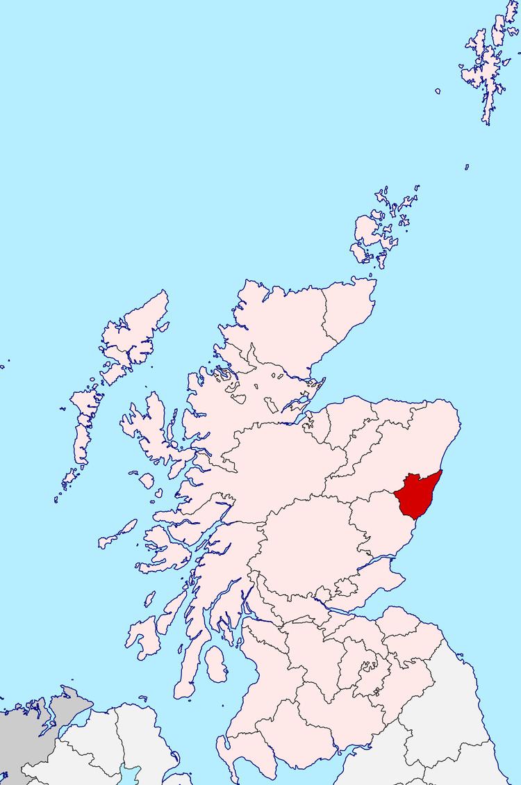
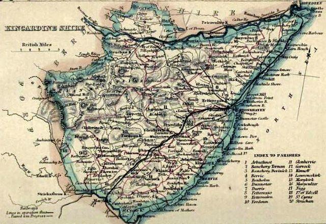
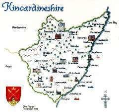
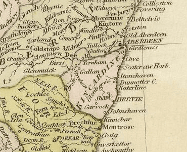
Kincardineshire, also known as the Mearns (from A' Mhaoirne meaning "the Stewartry"), is a historic county, registration county and lieutenancy area on the coast of northeast Scotland. It is bounded by Aberdeenshire on the north and west, and by Angus on the south.
Contents
- Ancestry genealogy photographs stonehaven kincardineshire scotland
- Salmon at falls of feugh banchory kincardineshire scotland
- Structures and sites
- Coat of arms
- Constituency
- Historic transport routes
- Notable people
- Natural features
- References
The name "Kincardine" is also used in Kincardine and Mearns, a committee area of the Aberdeenshire Council, although this covers a smaller area than the county.
The county town was originally the town of Kincardine (not, as many believe, the village of Kincardine O'Neil, which was in the County of Aberdeen). The town of Kincardine (not to be confused with Kincardine in Fife), however, ceased to exist during the Middle Ages. The only visible sign of its previous existence is the ruin of Kincardine Castle, 2 miles north-east of Fettercairn. In 1296, King John Balliol wrote a letter of surrender from the castle to Edward I of England after a short war which marked the beginning of the wars of Scottish independence. In 1600, the Estates of Parliament ordered the government of Kincardineshire to be conducted at the Stonehaven Tolbooth. The county extended to Hill of Fare north of the River Dee, but in 1891 the Royal Burgh of Torry on the south bank of the Dee was incorporated into Aberdeen.
The burgh of Stonehaven became the county town and the county included three other burghs, Banchory, Inverbervie and Laurencekirk. Other settlements include Drumoak, Muchalls, Newtonhill and Portlethen.
The county lost its administrative status in 1975. The area of Nigg in the north of the county became part of the City of Aberdeen, and the remainder of the county became part of the Kincardine and Deeside district of the Grampian region. When the Grampian region was divided into unitary council areas in 1996, the district was absorbed into the Aberdeenshire council area.
Salmon at falls of feugh banchory kincardineshire scotland
Structures and sites
Coat of arms
The county's coat of arms displayed and reflected the history of the Honours of Scotland, which were kept at Dunnottar Castle and later at Kinneff, both within the historical boundaries of the county, during the Wars of the Three Kingdoms. It was: Gules, the Sceptre and Sword of Scotland crosswise in saltire, with the Crown of Scotland in chief and a ruined castle on a mound in base, all or. The motto was LAUS DEO, Latin for "Praise God". It was originally the motto of the Viscounts of Arbuthnott, whose seat is in the county, and the 14th Viscount was Lord Lieutenant of Kincardine at the time of the arms' matriculation by the Lord Lyon in 1927.
Constituency
There was a Kincardineshire constituency of the House of Commons of the Parliament of Great Britain from 1708 to 1801 and of the Parliament of the United Kingdom from 1801 to 1918, representing the county of Kincardineshire, minus the parliamentary burgh of Inverbervie. Inverbervie was a component of the Aberdeen District of Burghs from 1708 to 1832 and of the Montrose District of Burghs from 1832 to 1950.
In 1918 the Kincardineshire constituency was merged with part of the Western Aberdeenshire constituency to form the Kincardine and Western Aberdeenshire constituency.
In 1950 Kincardine and Western Aberdeenshire was divided between the West Aberdeenshire constituency and the North Angus and Mearns constituency. North Angus and Mearns then covered the whole of the county of Kincardineshire, including the former parliamentary burgh of Inverbervie, and part of the county of Angus, the latter being previously within the Forfarshire constituency.
In 1983, eight years after the abolition of the local government county of Kincardineshire, North Angus and Mearns was replaced by new constituencies.
Historic transport routes
The ancient Causey Mounth road was built on high ground to make passable this only available medieval route from coastal points south to Aberdeen. This ancient passage specifically connected the Bridge of Dee to Muchalls Castle, Cowie Castle (and effectively Dunnottar Castle). The route was that taken by the Earl Marischal and Marquess of Montrose when they led a Covenanter army of 9,000 men in the first battle of the Bishops' Wars in 1639.
Elsick Mounth is a prehistoric trackway used by the Caledonian tribes as well as the Roman army in their northern invasion of the Scottish Highlands.
Notable people
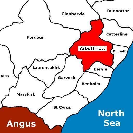
The author Lewis Grassic Gibbon, born James Leslie Mitchell, was a Scottish writer. His book Sunset Song is one of the most important Scottish novels of the 20th century. It was voted Scotland's favourite book, in a poll announced at the Edinburgh International Book Festival 2005. The book, set in a fictional village in the Mearns, drew heavily from Mitchell's upbringing in Arbuthnott. One of the key features of the book (and some of his other writing) is the balanced and immersive use of the local Doric Scots dialect mixed with standard English, in a manner to make it both easily and enjoyably accessible to someone unfamiliar with the North East of Scotland.
Natural features
There are numerous natural features within Kincardineshire. Among the rivers are Cowie Water, Carron Water, Luther Water, Burn of Muchalls, Burn of Pheppie, Burn of Elsick, Burn of Monboys, Bervie Water and the lower reaches of the River Dee.