
Population 11,390 (Dec 2012) | Area 37.57 km² | |
 | ||
Time zone Japan Standard Time (UTC+9) Weather 17°C, Wind NW at 26 km/h, 77% Humidity Points of interest Kinkannon‑ji Temple, Ookawa Children's Park, Iwako Bayan Park, Jinwu Regional Park, Kin Dam | ||
Kin (金武町, Kin-chō, Kunigami & Okinawan: Chin) is a town located in Kunigami District, Okinawa Prefecture, Japan.
Contents
- Map of Kin Kunigami District Okinawa Prefecture Japan
- Geography
- Neighboring municipalities
- Districts
- Government
- Noted places
- United States military bases
- References
Map of Kin, Kunigami District, Okinawa Prefecture, Japan
In 2012, the town had an estimated population of 11,390 and a density of 300 persons per km2. The total area of Kin is 37.57 square kilometres (14.51 sq mi). 59% of the land area of Kin remains under control of the United States military, the highest percentage of any municipality in Okinawa Prefecture. The population of the town is concentrated on a strip of land on the coast of Kin Bay. Kin is home to Camp Hansen, a military base of the United States Marines, as well as other smaller military installations.
Kin is home to the Dragon Brand of awamori, with a beautiful Buddhist shrine built in 1522, and a 270-meter natural cave known as Kin Shonyudo that doubles as both a place of worship and a cellar for aging bottles of the drink. Kin is also claimed to be the origin of taco rice, a dish emblematic of modern Okinawan cuisine.
Geography
Kin is located at the middle of Okinawa Island, and is roughly triangular in shape. The town is roughly 13 kilometres (8.1 mi) long from east to west. From north to south the town ranges between 2 kilometres (1.2 mi) to 8 kilometres (5.0 mi) at its widest point, measured from Būtodake in Camp Hansen to the tip of Cape Kin.
Neighboring municipalities
Districts
Kin is divided into five districts.
Government
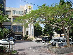
Kin is governed from the Kin Town Office in the central district of the town, also known as Kin. The municipal Board of Education oversees the middle school, three elementary schools, three nursery school, and other community facilities in the town. The Kin Municipal Assembly consists of 16 members who serve a four-year term, and are led by a chairperson and vice-chairperson.
The Okinawa Prefecture Police provides law enforcement for Kin; the town has no municipal police service. The Ishikawa Police Station, located in nearby Uruma, covers Kin, as well as the town of Onna, Ginoza, and the Ishikawa area of Uruma.
Noted places
Kin is home to the Kin Kannon-ji, a Buddhist temple that traces its history to the 16th century. By tradition the temple was constructed by Nisshō Shōnin, a resident of Ise who was attempting to travel to China. Nisshō Shōnin was shipwrecked in the Ryukyu Islands, and took refuge at the small port of Funaya in Kin. There he founded the temple. The hondō main hall of the temple was reconstructed in 1942. Unlike most structures in southern Okinawa Island, it was not destroyed in the Battle of Okinawa. The wooden structure is designated an important cultural property by the Town of Kin. The temple additionally serves as a site for the display of traditional handicrafts, festivals, and performances.
United States military bases
Kin is home to Camp Hansen (51.4 square kilometres (19.8 sq mi)), a U.S. Marine Corps base that supports ground combat, communications, 31st MEU(SOC), 7th Communication Battalion, 9th Engineer Support Battalion, 12th Marine Regiment, 3d MEF Headquarters Group, 3 MEF Special Operations Training Group Small Craft Raid Platoon and other battle elements. Historically, Kin is known as an entertainment location for the U.S. Marines stationed there.
Although there have been recent military backlashes in Okinawa, Kin is very welcoming to the military, as they receive income for such things as port use, tourism, and merchants. After the terrorist attacks of 9/11, Marines from U.S. 3d Marine Division were able to leave directly out of the ports in Kin via HSV Ferry to deploy to other areas in the Far East rather than flying.