Harman Patil (Editor)

Kimotsuki District, Kagoshima

Updated on
Edit
Like
Comment
Share on FacebookTweet on TwitterShare on LinkedInShare on Reddit
Kimotsuki District, Kagoshima

Points of interest
  
Ōsumi Peninsula, Cape Sata, Kamikawaōtaki Park, Satamisaki Lighthouse, Kamikawa Camping Ground

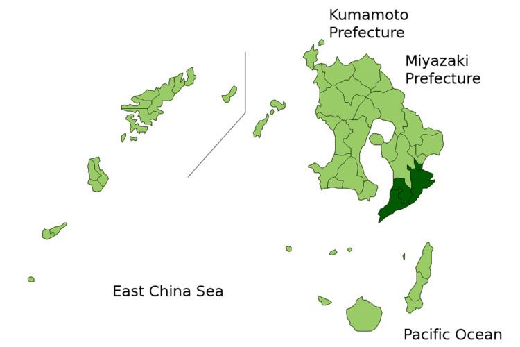
Kimotsuki (肝属郡, Kimotsuki-gun) is a district located in Kagoshima Prefecture, Japan.

Contents

Map of Kimotsuki District, Kagoshima Prefecture, Japan

As of the January 1, 2006 merger but with 2003 population statistics, the district has an estimated population of 46,943 and a density of 65.9 persons per km². The total area is 712.55 km².

Towns and villages

  • Higashikushira
  • Kimotsuki
  • Kinkō
  • Minamiōsumi
  • Mergers

  • On March 22, 2005 the towns of Ōnejime and Tashiro merged into the town of Kinkō.
  • On March 31, 2005 the towns of Nejime and Sata merged into the town of Minamiōsumi.
  • On July 1, 2005 the towns of Kōyama and Uchinoura merged into the town of Kimotsuki.
  • On January 1, 2006 the towns of Aira and Kushira, and the town of Kihoku, from Soo District, merged into the expanded city of Kanoya.
  • References

    Kimotsuki District, Kagoshima Wikipedia