
Country North Korea Province Ryanggang Province | Area 1,473 km² | |
 | ||
Administrative divisions 1 ŭp, 6 workers' districts, 9 ri | ||
Kimhyŏngjik County is a kun of Ryanggang Province, North Korea. Formerly known as Huch'ang County, it was renamed in 1988 after Kim Il Sung's father, Kim Hyŏng-jik.
Contents
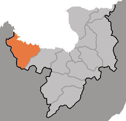
Map of Kimhyongjik, North Korea
The 2004 Ryanggang explosion occurred at Wŏltal-lodongjagu in this county.
Geography
Kimhyŏngjik is located in the northwestern part of the Kaema Plateau. It borders China to the north (Yalu River region). Although the south is a plateau region, the Yalu River is in the north. The Hŭisaekpong and Rangrim mountain ranges are partly in this county. The highest peak is Hŭisaek-pong. The region bordering on the Yalu River is mainly precipices. The main streams are the Yalu River and its tributaries. The county's land area is 93% forested.
Administrative Divisions
Kimghyŏngjik county is divided into 1 ŭp (town), 6 rodongjagu (workers' districts) and 9 ri (villages):
Economy
Forestry is the main industry. The main rivers are used to transport timber. Iron, gold, silver, copper, tungsten, graphite and nickel deposits are found in the county. Agriculture is also practised. Red pepper, corn, beans, potatoes, rice and flax are mainly produced. Sericulture is also practised.
Transportation
The Pukpu Line of the Korean State Railway and various roads serve the county.